Newsletter Autumn 2022

Autumn 2022
Newsletter
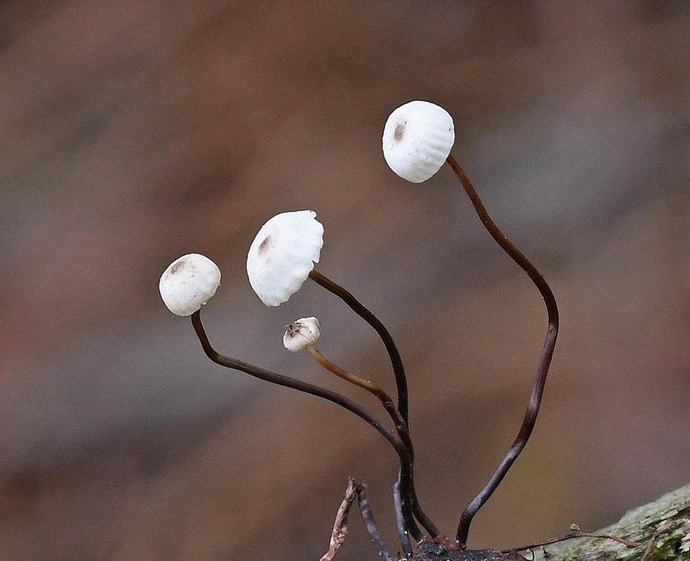
Collared Parachute (Marasmius rotula) on twig litter (Marasmioid mushrooms) with thanks to Paul Kitchener
SBIS News
Projects
Lidar-derived tree canopy polygon data
Canopy cover
The analysis of this data from Norfolk County Council continues. We now have Parish level statistics for canopy cover in Historic Parks and Gardens, Wood-Pasture and Parkland and County Farms. For County Farms, this was extended to include tree canopy by type (conifer, broadleaf, scrub, and non-woodland trees).
The University of East Anglia (UEA) is now working on a natural capital assessment of the County Farm estate with input from SBIS.
Hedgerows
We produced a dataset of farmland field boundaries from the Ordnance Survey MasterMap data. Next, we classified hedgerows by overlaying this with the canopy polygons, using statistics (including min, max, mean, and standard deviation) for treed lengths, gappiness, canopy area, height, estimated volume and the total number of tree canopies.
Following on, we will produce figures for these at the Parish level.
SBIS met with Norfolk GIS staff to coordinate the approaches of both counties to the project.
County Wildlife Sites, Roadside Nature Reserves, County GeoSites
Suffolk Wildlife Trust is continuing to rewrite many CWS citations, which we are incorporating into our database.
The CWS Panel visited Carlton Marshes and Oulton Marshes to assess the recently acquired Suffolk Wildlife Trust areas for inclusion in the CWS boundary (see pp. 9–12 for more details).
Areas which meet the criteria will be mapped by SBIS and included in the Register.
Data updates to SLA Partners
The 6-monthly GIS data updates were made available on the SBIS website in June. In addition, notification emails, including the download links, were sent out to those who access the data. The next updates will be available in December.
Native Black Poplar Survey recording form and map
The map and survey form is live and accessible via an emailed link to registered volunteers and Suffolk Tree Wardens. The map shows mature trees and planted saplings.
Tree wardens and volunteers will survey the existing mature trees shown on the map in the field, and records of their continued presence (or otherwise) will be submitted using the form. In addition, if they discover new trees while surveying, they can record them using the same form. We have included instructions on using the map and recording form on the web page, and registered users must log in to the website to view them.
The Native Black Poplar Recorder, Sue Hooton, will verify all new information, and SBIS will then update the data and online map.
Other data
Two habitat and land cover datasets have been imported and made available across Suffolk County Council:
Natural England’s Living England Habitat Map (Phase 4) (satellite-derived polygon layer). Further information is here.
Centre for Ecology and Hydrology’s Land Cover Map 2020 (10m Classified Pixels). Further information is here.
Other activity
We supplied data and have participated in meetings concerning the Local Nature Recovery Strategy with UEA and the Norfolk and Suffolk Mapping Group.
We also met with Suffolk and Norfolk County Council’s respective IT departments to discuss a proposed online GIS to disseminate natural environment information.
Average weekly searches and records processed 2019 to 2022
Commercial Data Enquiries
For 2022, up to the 1st of October, we have processed an average of 11 searches per week, supplying 11738 records weekly. For the same period last year, there was an average of 12 searches and 11717 records processed a week. There was a slight average increase in records produced per search to 91.
SBIS website library expands
A project to digitise the earliest issues of the Suffolk Argus (the newsletter of the Suffolk branch of Butterfly Conservation) has been completed and these along with back issues of the Harrier (the newsletter of the Suffolk Bird Group) are now available in the online library, www.suffolkbis.org.uk/publications
Ancient Woodland Inventory Update
Hannah Alred, Suffolk Biodiversity Information Service
Phase 2 of this project will commence in 2023 and includes gathering evidence of ancientness from historical documents, and we will access many of them at The Hold’s archives.
Field survey work is set to take place early in 2023 to provide further evidence of ancient woodland indicator species. We will be calling for volunteers to help undertake this work after Christmas. If you are interested in undertaking botanical field surveys and have experience in this area, please email [email protected] to add your name to our volunteer waiting list.
© Crown copyright and database rights 2022 Ordnance Survey 100023395
The Ancient Woodland Inventory (AWI) identifies woodlands that have had continuous woodland cover since the 1600s. Studies show that these are typically more ecologically diverse and of a higher nature conservation value than those developed recently.
In the 1980s, the Nature Conservancy Council instigated the AWI, which attempted to identify all ancient woodlands in the UK. However, it used tracings from paper maps. As a result, it contained many boundary discrepancies and didn’t include woodlands under 2 ha.
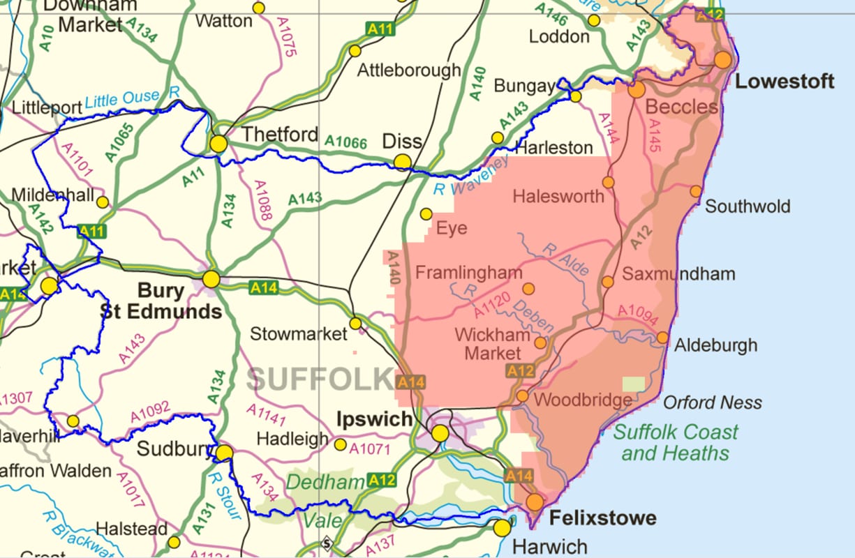
The AWI is a valuable resource that protects known ancient woodlands through planning and policy. It is the definitive list of ancient woodland boundaries and is used, for example, within conservation or development projects nationally. Therefore, updating it is key to ensuring accuracy and protecting ancient woodland in Suffolk. The current AWI has around 4,524 ha of ancient woodland registered within the county’s 385,245 ha, roughly 1.2%.
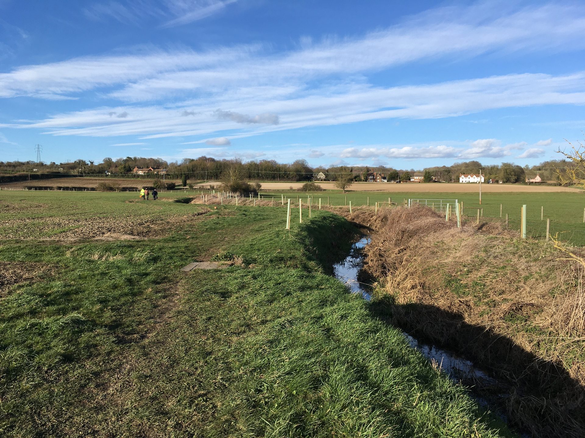
Phase 1 of the work on the update project began in 2021, and, to date, 155,974 ha (156 km²) of Suffolk have been checked for long-established woodland (see Map) by using aerial photographs and the Epoch 1 Ordnance Survey map that dates from the 1860s to 1880s.
Council scheme helps Harleston’s wildflower Jubilee Meadow bloom
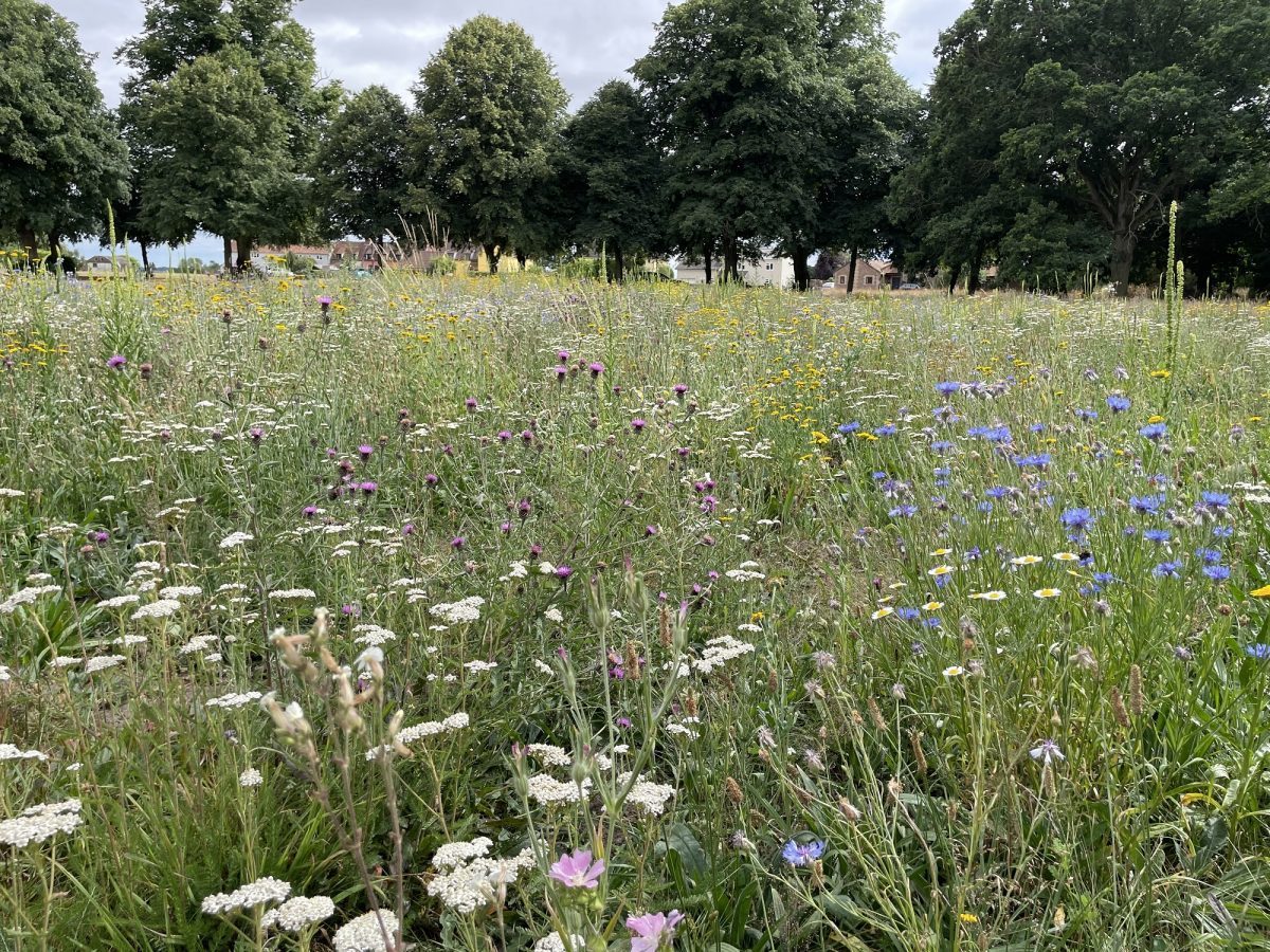
Harleston’s wildflower Jubilee meadow showcases a colourful example of how two Suffolk councils are helping to tackle biodiversity and climate change.
Babergh and Mid Suffolk District Councils recently relaunched one of their headline biodiversity schemes, which sees them gift thousands of trees, hedgerow plants, and wildflower seeds to eligible organisations. Forming part of the councils’ Biodiversity Action Plan, it aims to help protect and strengthen plant and wildlife across the districts, working alongside local communities. This year, the scheme was extended to welcome applications from community groups and landowners with publicly accessible land.
A stunning example of how the district-council-funded seeds have already made a difference can be found in Harleston, just a few miles outside Stowmarket.
In April last year, Harleston Parish Meeting used the scheme to create a new wildflower ‘Jubilee Meadow’. Supported by an army of volunteers and local farmers, they transformed part of the village green to give it back to nature. Despite little rain and extreme heatwaves since seeding, the meadow bloomed into a sea of colourful flowers and has proved a hotspot for the local butterfly population. In addition, rarer species, such as Small Copper and Brown Argus, have been spotted enjoying their new source of food and shelter. The parish also has thriving beehives close to the meadow, helping them create a circular system by reinvesting the money made from selling local honey back into the meadow and local area.
Andy Wilks, chair of Harleston Parish Meeting, said: “Following the brilliant initiative by the councils to offer free wildflower mix to help promote insect and butterfly life, we took the decision to turn over part of our village green to a wildflower meadow. The results have been fantastic – lovely meadows full of butterflies and other insect life.”
While the formal deadline for the 2022 scheme has closed, the councils are still accepting applications, with organisations encouraged to apply or discuss their project.
Long-term care and maintenance of trees, hedges and wildflower meadows planted under the scheme are the responsibility of the parish or organisation concerned; however, the district councils are available for advice.
Cllr Jessica Fleming, Mid Suffolk District Council’s cabinet member for environment, said: “Protecting and strengthening our local plant and wildlife to increase biodiversity is one of our key focuses in tackling climate change. It is lovely to see that even with the harsh conditions and drought we’ve recently experienced, projects supported by our tree, hedgerow and wildflower scheme are flourishing – with Harleston’s wildflower meadow being just one shining example.
The tree, hedgerow and wildflower scheme is just one of the steps the councils are taking to support biodiversity, including:
- changing grass-cutting regimes and introducing wildflower meadows on council-owned land,
- increasing tree coverage using detailed tree canopy data,
- gifting well over 1000 trees to new parents through their Tree for Life scheme,
- successfully securing a share of £150k with other Suffolk councils to plant around 3,000 trees in the county. 200 of these are located across Broom Hill in Hadleigh, Needham Lake in Needham Market, and Greens Meadow in Stowmarket and were dedicated to the Queen’s Green Canopy in Suffolk,
- finalising mapping of existing and potential wildlife corridors.
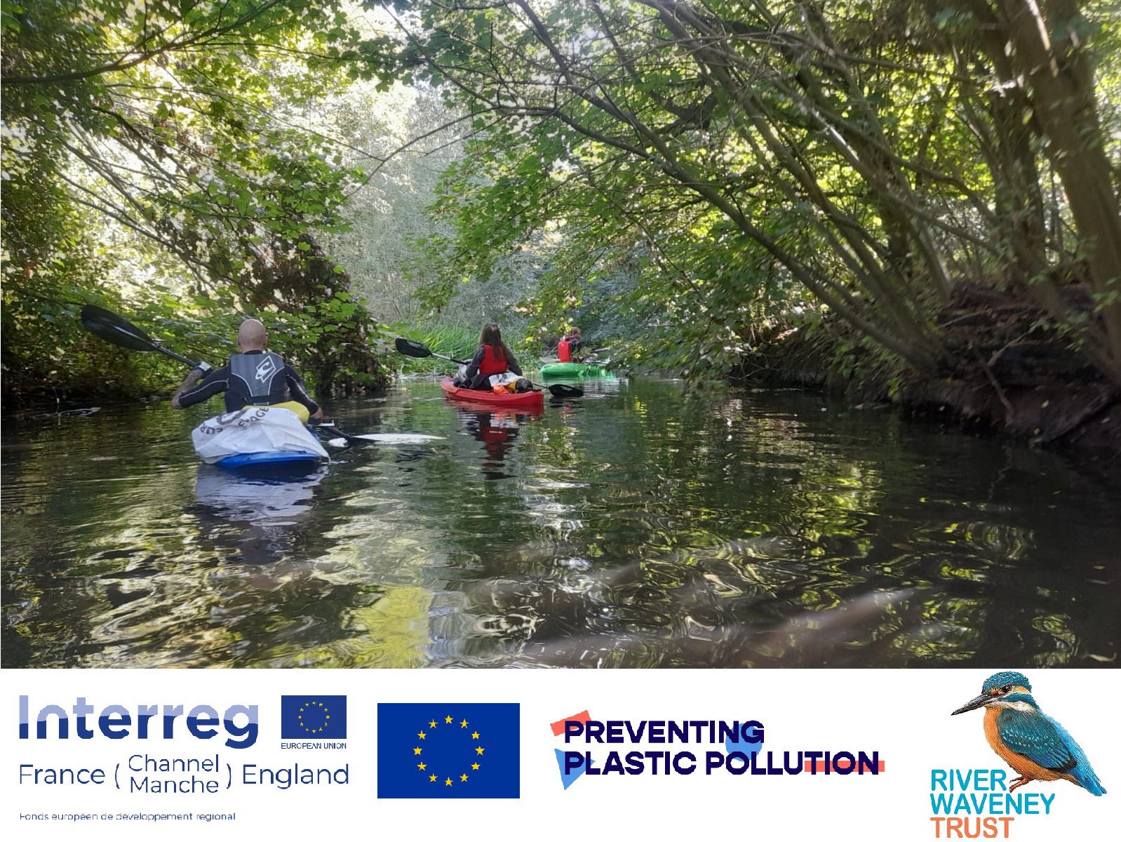
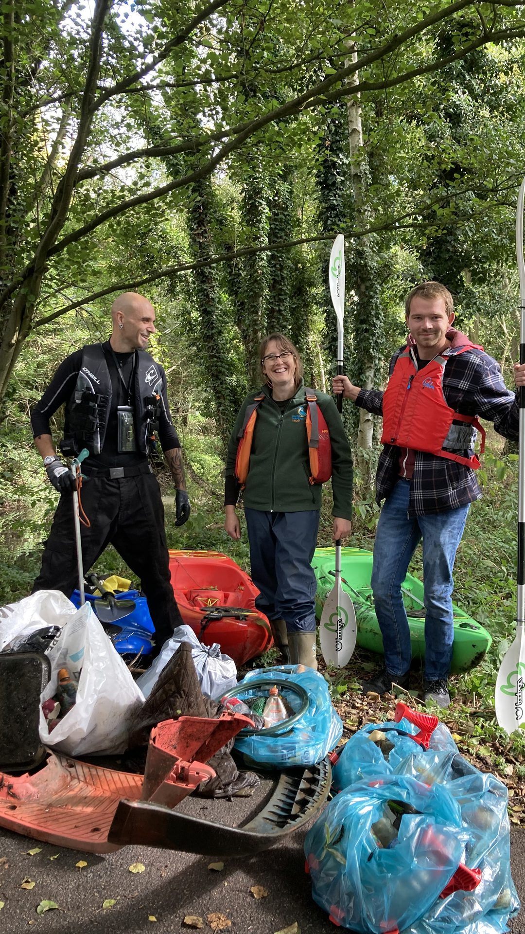
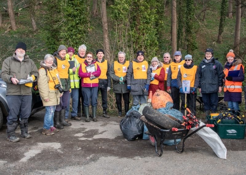
Preventing Plastic Pollution on the River Waveney – one drinks bottle at a time
Ange Lamb, River Waveney Trust

The River Waveney Trust are taking part in the Preventing Plastic Pollution (PPP) project, and we are aiming not only to remove all types of litter from the river and its banks but also to identify litter hotspots and work with communities to address these and reduce the amount of plastic that gets into the river.
The PPP project extends across the south and east of England and northern France. The River Waveney Trust and many other organisations will contribute data to the bigger picture to better understand the problem of plastic pollution in the marine environment. Litter finds its way into rivers in several ways, dropped on our streets, blown out of bins or landfills, flushed down toilets, washed down storm drains and sometimes intentionally thrown into rivers. Around 80% of the plastic that eventually ends up in our oceans gets there via rivers; it is a global problem requiring local and international solutions.
Once plastic is in our rivers and oceans, it has a devastating impact, entangling wildlife or being mistaken for food and intentionally eaten by birds, fish and mammals - both lead to poor health and premature death. Plastic breaks down into smaller and smaller pieces – micro-plastics and nano-plastics; the impact of this isn’t yet fully understood. Still it’s known that marine animals ingest micro-plastics that they mistake for small food particles, clogging up their digestive system and causing inflammation and laceration to digestive tissues.
The River Waveney Trust are lucky to have a band of wonderful volunteers that care for various sites along the river. For example, in Diss, a dedicated group looks after Frenze Beck County Wildlife Site and regularly carries out litter picks along the banks of the Waveney. Further up the river, there are River Waveney Trust groups in Harleston and Beccles, who, amongst other tasks, also pick litter. Other groups such as The Otters Trust, Diss Litter Picking Group and Beccles Bombles also do a great job tackling plastic pollution.
The first ‘on the water’ litter pick took place on 1st Oct; a small group of committed River Waveney Trust staff and volunteers gathered in the car park at Tesco Diss with paddles, litter pickers and empty bags at the ready. With the sun shining down through the trees, creating an idyllic scene, the group launched their kayaks from the riverbanks just behind the supermarkets. Sadly litter and pollution made for a less-than-perfect trip, and the participants became angrier and more upset at the state of the river as they made their way upstream.
Six bags of rubbish were removed from the Waveney, a total weight of 9.5kg, approximately 3.5kg of that was plastic. This included 54 plastic drinks bottles and some larger unusual plastic items – a car bumper, a wheel arch liner, a quad bike foot plate and a plastic-wrapped real Christmas tree! There were some gross items too, a toilet cleaner rim block, the plastic mesh filter that had come away from the sewage overflow and five condoms. All of this was found in a stretch less than half a mile long.
Litter is just one of the contributors to poor water quality along the stretch of the Waveney that runs through Diss. The group paddled past two sewage overflows where they saw wet wipes and sanitary products washed into the river after the recent rainfall. With a population of over 10,000 people in Diss, it is sad that we can’t safely recommend that they get themselves out on or in the river to enjoy it because it poses a risk to their health. We would love to hear from the residents of Diss. We want to know what they think about the current state of the Waveney and how it can be improved
There are 12 more litter picks planned as part of the PPP project, which is being delivered in partnership with Groundwork East. The project is funded by the EU Interreg France Channel England Programme with support from Spectra Packaging in Halesworth and the Broads Catchment Partnership. The dates for litter picks can be found on the River Waveney Trust website
www.riverwaveneytrust.org
For more information, contact Angela Lamb, Volunteer & Events Coordinator with the River Waveney Trust: [email protected] or 07810 214831
One for The Repair Shop?
Ian Barthorpe, Visitor Experience Officer, RSPB Minsmere

As regular readers will know, we’ve been celebrating 75 years of Minsmere as an RSPB nature reserve this year. It’s also 60 years since Bert Axell first created the Scrape. With these two milestones in mind, two recent discoveries have even more significance.

One of these was found close to the old access path to East Hide, so an unfortunate birdwatcher may have dropped them, but there is no public access where the second pair was found, so a previous warden or volunteer may have lost them.
One set is still in remarkably good condition, though they would need a lot of work to make them usable. Nevertheless, I was quite excited to see these as I was given an identical pair for my 18th birthday! They are Carl Zeiss Jenoptem 10x50s, built in East Germany between 1971 and 1990.
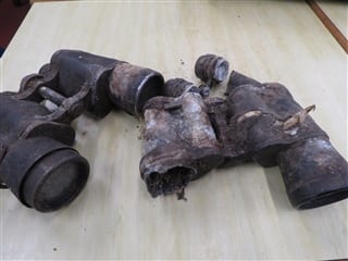
While constructing the long-awaited new accessible boardwalk to East Hide, our contractors, Gilliards, have unearthed not one but two pairs of old binoculars buried in the edge of the reedbed.
Zeiss was split into two companies when Germany was divided after the Second World War. Following the reunification of Germany, the East and West German companies were merged again, with Zeiss continuing to make very high-quality binoculars and telescopes.
All Zeiss binoculars have a unique serial number, and remarkably we can still read the number on this model - 6690576. It will be interesting to know whether Zeiss can track down details of where and when these binoculars were sold!

The second model, which looks a bit worse for wear, are Tasco 7x50s, but that’s all we can say. They must have been buried for some time, as there’s even a reed root growing through the casing.

We’re now trying to decide whether there is anywhere that we can display these exciting finds. However, it also raises another question. Exactly what else is buried beneath Minsmere’s varied habitats?

SUDBOURNE PARK SSSI
Caroline Markham, GeoSuffolk
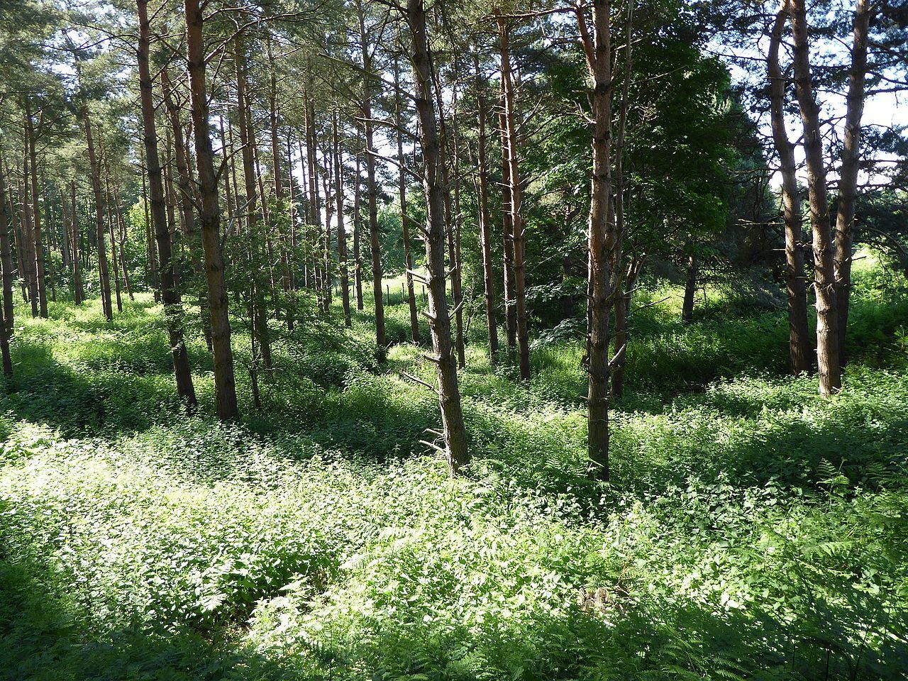
Image: Dudley Miles
(Wikimedia, Creative Commons)
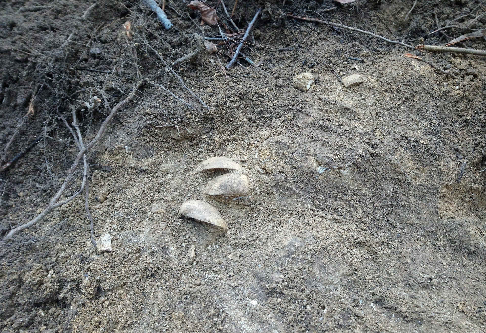
The geological SSSI in Sudbourne Park is designated for its Coralline Crag fossil fauna – bivalves and bryozoans in particular.
The geological SSSI in Sudbourne Park is designated for its Coralline Crag fossil fauna – bivalves and bryozoans in particular. With the Coast and Heaths Work Party, it was the last site GeoSuffolk visited before the Covid-19 restrictions and the first we visited when restrictions were lifted. In March 2020 and December 2021, the pit was cleared of vegetation and talus using spades, rakes and wheelbarrows. Aiming to make access possible for research workers using hand tools, several small exposures in the Coralline Crag were cleared, some showing fossil molluscs in situ (Photo 1) and one with a solution pipe.
Fossil molluscs in a small exposure at Sudbourne Park, December 2021
In December 2021, GeoSuffolk was contracted by the Geology Trust to survey Sudbourne Park for Natural England and, following our work with the SCH AONB, we reported it in good condition. Access to features mentioned in the SSSI citation is good – an excellent example of what can be achieved with a supportive landowner*, a little local knowledge and a lot of hard work! (Photo 2). *The SSSI is on private land but can be seen from the Chillesford to Orford footpath.
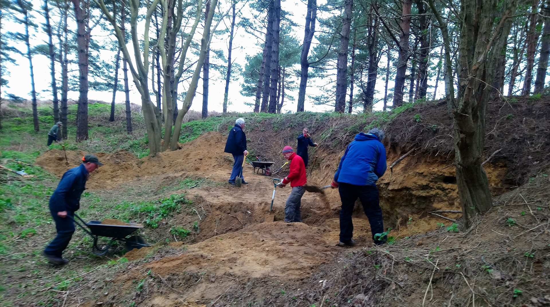
The SCH AONB Work Party at work, March 2020
Coralline Crag, found only in Suffolk, was laid down 3.5 to 4 million years ago at a time of relatively warm climate before the onset of the Ice Age. Its fossil molluscs, Arctica islandica (Photo 3), Cardites and Glycimeris, are currently used in research that informs climate change modelling. These animals were very long-lived – growth rings in their shells indicate some individuals may have lived for over 200 years. Oxygen isotope analysis of the material in the growth rings gives clues to the varying temperatures in the North Sea 3.5 to 4 million years ago.
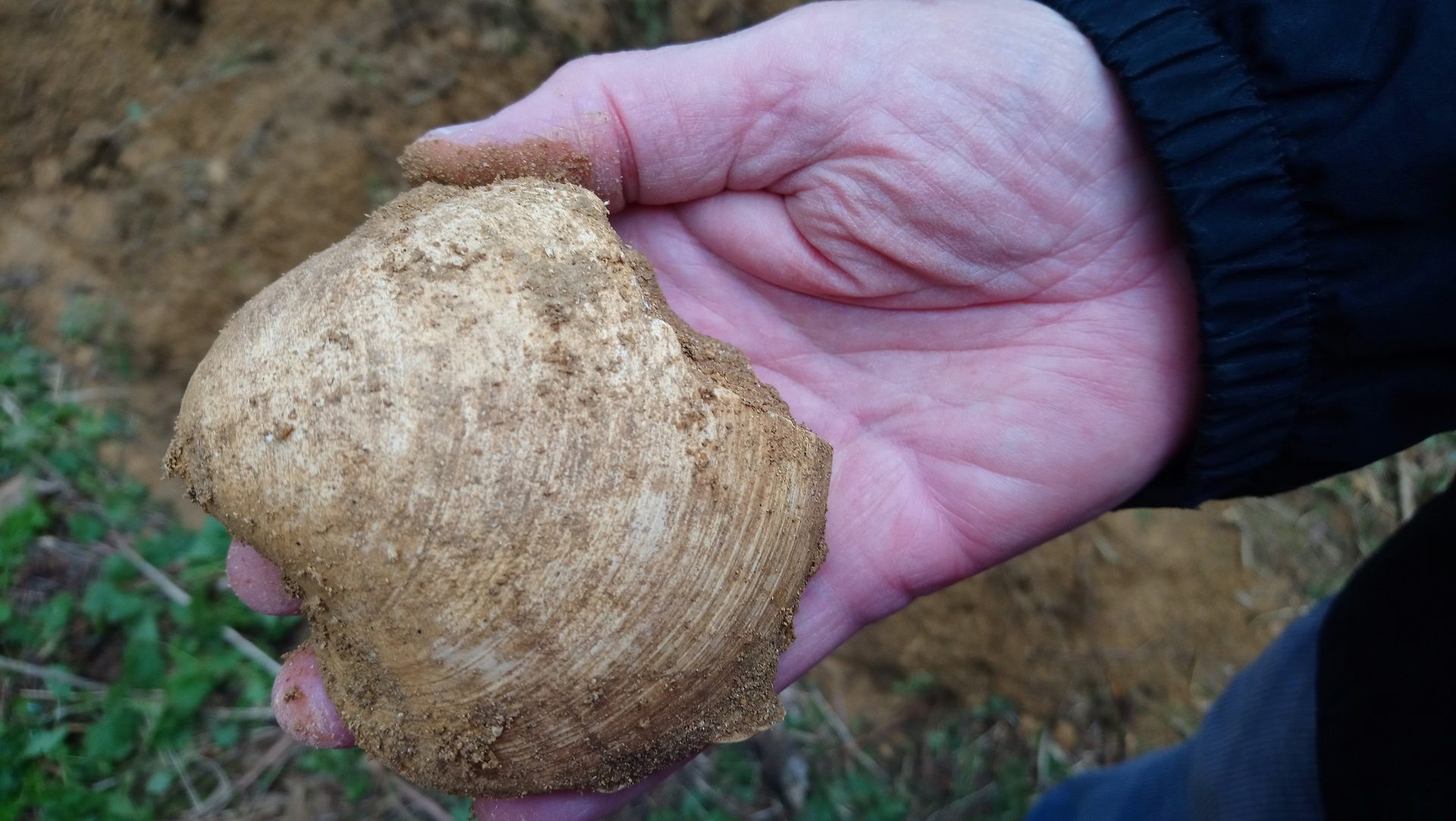
A fossil Arctica Islandica, March 2020 – this large specimen was probably well over 100 years old when it died.
County Wildlife Sites visits
Emma Aldous, Suffolk Biodiversity Information Service
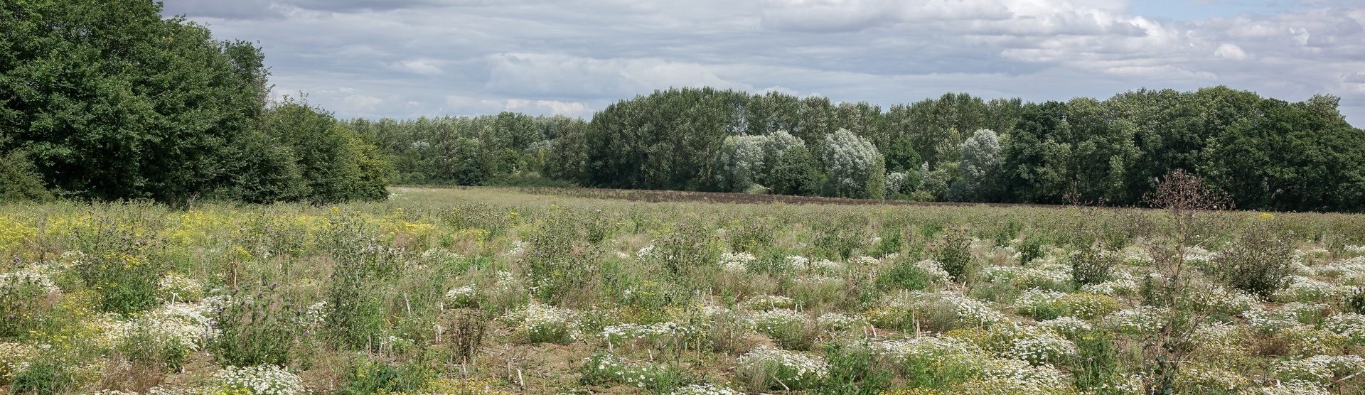
Image: Black Bourn Valley,
Suffolk Wildlife Trust
Members of the County Wildlife Site (CWS) panel visited three Suffolk Wildlife Trust (SWT) Nature Reserves to review and extend the existing CWS boundaries. They were looking for habitat indicator species and conducting habitat quality condition assessments. Thanks to the Suffolk Wildlife Trust wardens – Will, Sam, Matt and Lewis – who guided the panel around the reserves and shared their time and knowledge.
20 July – Black Bourn Valley Nature Reserve
Originally an arable farm, Black Bourn Valley was gifted to SWT in 1995. The ‘wilding’ process began with nature being allowed to take over one field twenty years ago. In 2017 arable farming stopped altogether, and the reserve is reverting naturally, creating a mosaic of transitional habitats.
The panel was guided around the 119 hectares of the reserve, learning about the management and looking at the results of the wilding process, with some great examples of natural succession – hedgerows becoming dense scrub and expanding into the field margins, fields becoming dominated by Bristly Oxtongue and Thistle.
The Trust uses Cattle for conservation grazing across the reserve, and new ponds were created and left to regenerate naturally. Since then, surveys identified 17 Nationally Notable and Local Notable aquatic invertebrates as well as the Nationally Scarce Tassell Stonewort. Its rich variety of ponds led to it being designated Flagship Pond Site. In winter, the Black Bourn is allowed to spill out across the meadows attracting flocks of wintering birds.
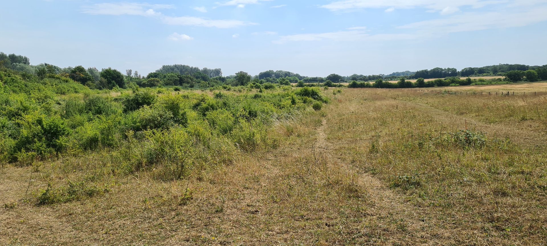
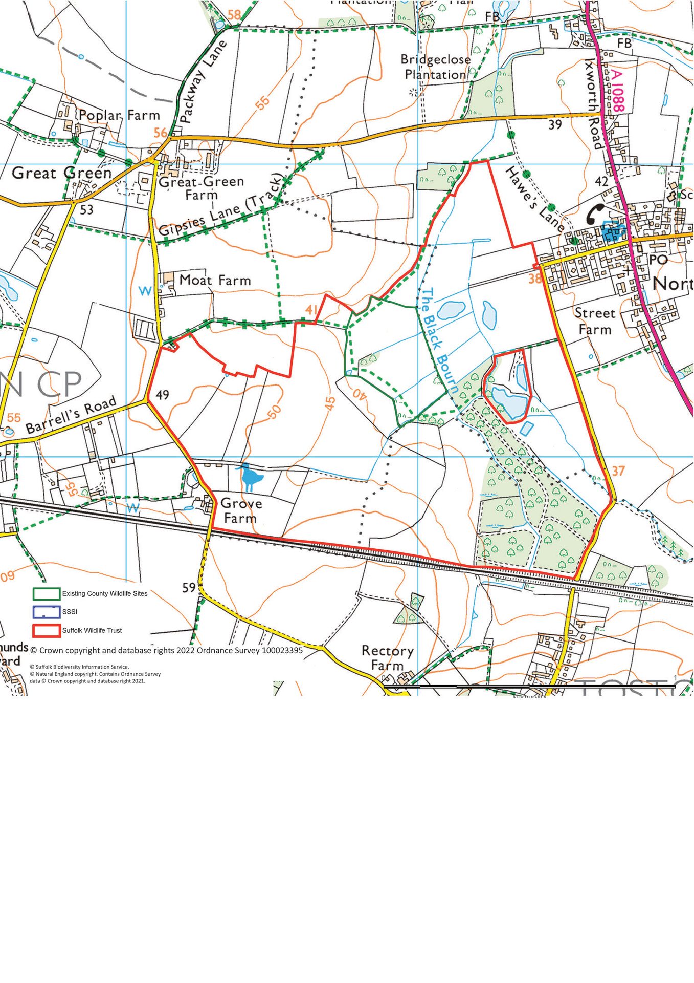
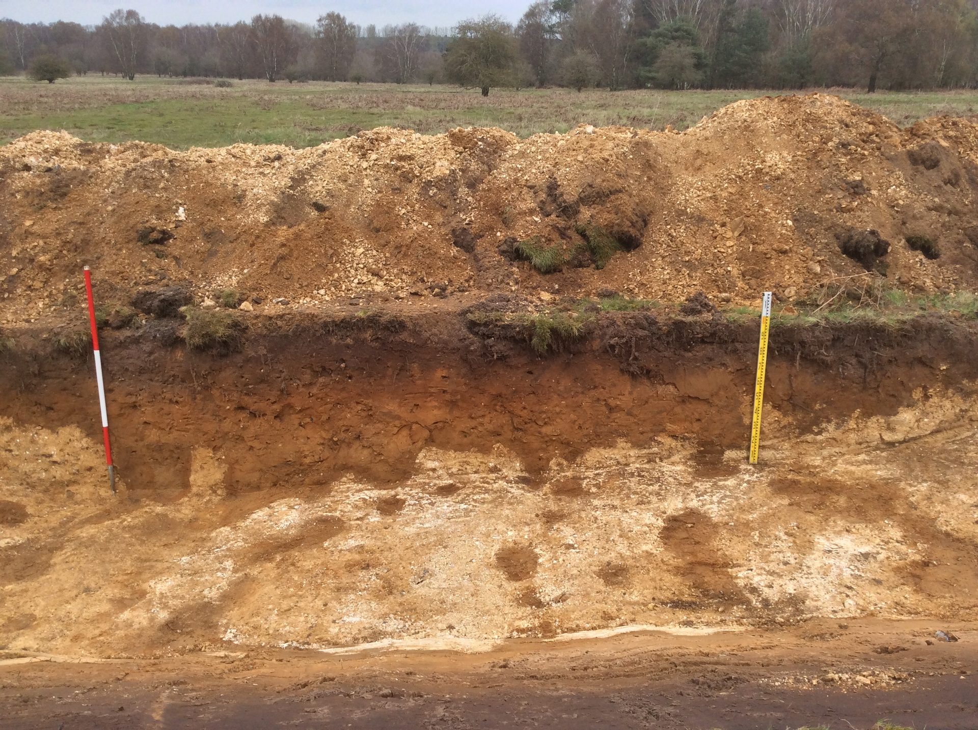
Image: © Breaking New Ground Knettishall Heath project
20 July – Knettishall Heath Nature Reserve
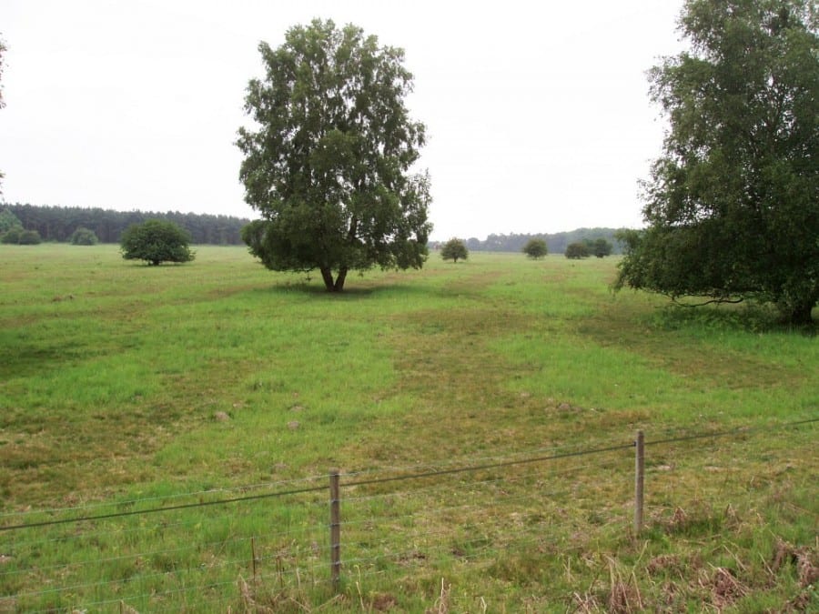
The panel also visited Knettishall Heath Nature Reserve, taken on by SWT in 2012, where the warden guided them around the 175-hectare site. They assessed the areas around the central SSSI for habitat connectivity, buffer zones and other CWS criteria. There is a fascinating mix of habitats at Knettishall Heath, including heathland, woodland and riverside meadows.
You can find one of Suffolk’s largest surviving areas of Breckland heath and patterned vegetation here. Extreme frost action 450,000 years ago sorted the sand and chalk soils into stripes and polygons, with different plants growing on each soil type.
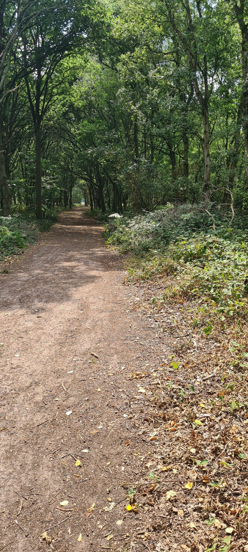
Image: A GeoSuffolk/Suffolk Wildlife Trust excavation across a vegetation stripe, shows white chalk exposed in its base and a trough filled with orange sand. © GeoSuffolk
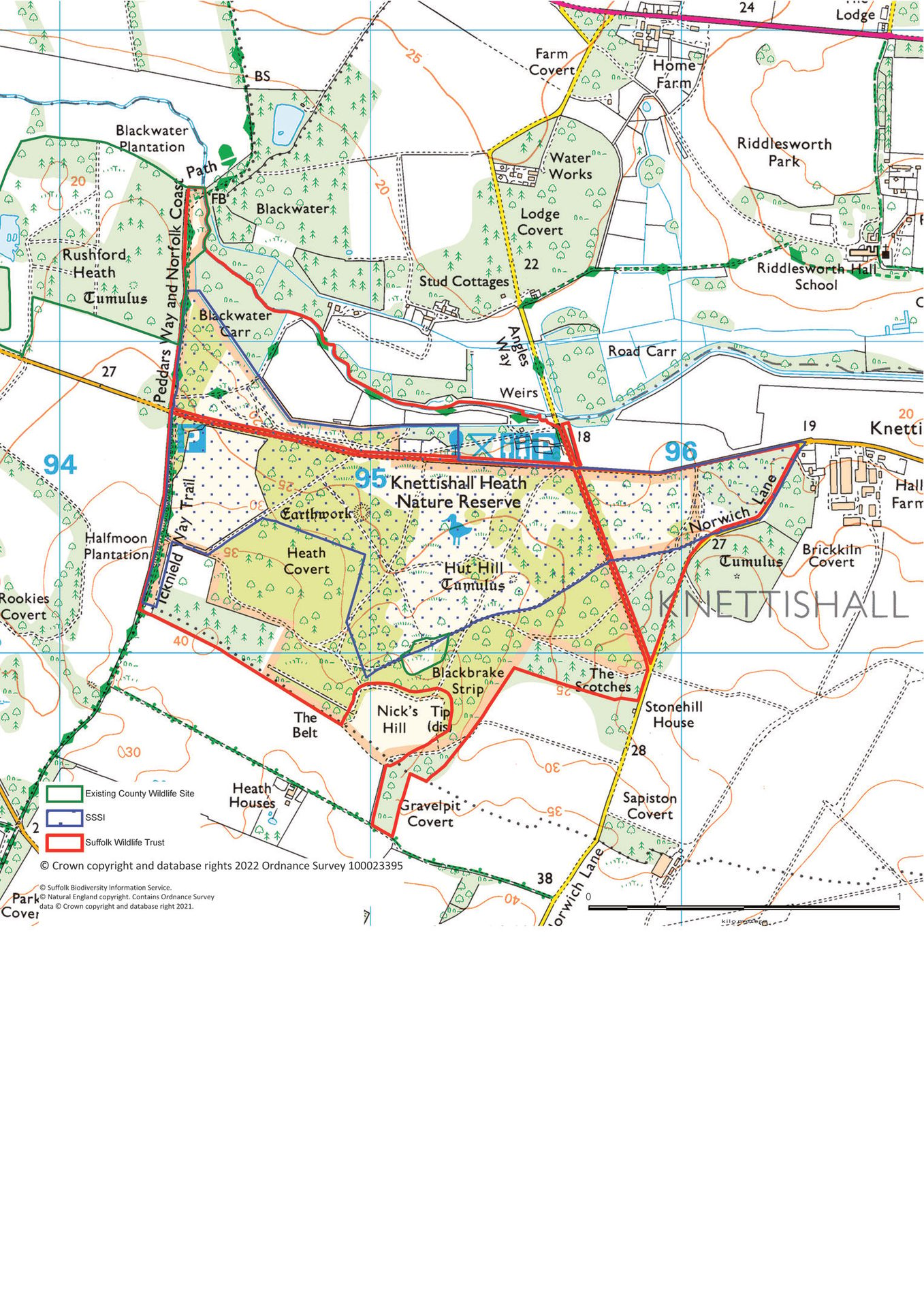
Image: Graham Keen (Flickr)
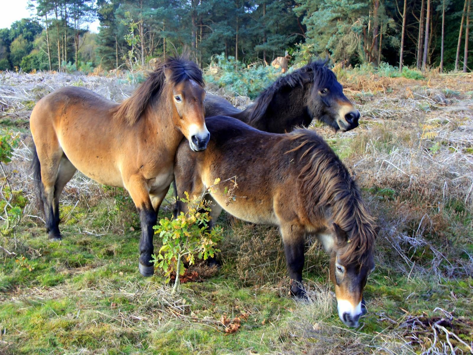
Recent management of Heath Covert included felling trees in an overgrown section to create a wood pasture with open glades and widen the rides. In addition, SWT is using Exmoor Ponies for conservation grazing across the reserve. The ponies’ grazing has helped to increase the growth of Breckland plants such as Purple Milk Vetch, Breckland Thyme and Ling Heather and improved the nesting environment for Skylarks and Woodcocks. Other species, such as Woodlark and Stonechat, have made a good comeback since the restoration and the odd Nightjar. While the team was assessing the existing CWS, the herd cantered past, to the delight of some team members.
12 October – Carlton Marshes
At over 405 hectares, this is the largest of the SWT reserves. Here, nature is allowed to take over and create a new wild area. With a jigsaw of grazing marsh, fens, peat pools, short fen meadow, tall fen (called ‘tall litter fen’), dykes, pools and scrub. Often the result of human activity such as peat digging, these habitats have developed over centuries of traditional management. They are now home to specialised wildlife, such as the rare Fen Raft Spider, which was introduced in 2012.
The diversity of freshwater snails found in the pools and dykes reflects the quality of the water across the reserve. In addition, staff and volunteers at the reserve have recorded an astounding 28 species of dragonfly. Reed and sedge beds along the river wall make perfect nesting cover for many birds, including Reed and Sedge Warblers, Bearded Tit, Cetti’s Warbler and Marsh Harrier.
The panel found it hard to believe that Peto’s Marshes had been arable farmland just seven years ago. The change results from a four-year habitat creation programme, begun in 2012, to create a ‘wild’ landscape of reedbeds, pools and scrapes.
During their visit, the team saw a Marsh Harrier and Bittern flying over and several Chinese Water Deer darting across the tracks. Unfortunately, despite spotting spraint and a well-beaten path over the dyke wall, the team were not lucky enough to see Otters on this visit. However, a nearby trail camera often catches images of the Otters as they head from Outon Dyke into Peto’s Marsh, which they use as a shortcut to the River Waveney.
Cattle graze the marshes in the summer, and the Trust now have three Exmoor Ponies for grazing the land unsuitable for the cattle. Over the winter, there are plans for an experimental scheme of scrape management that will use pigs to break up the ground and dig holes.
The Trust has worked hard to ensure the water levels through the reserve remain as consistent as possible throughout the year. For example, at Oulton Marshes, they have installed a new wind pump to top up the scrapes with water. Keeping the water levels consistent throughout the year helps invertebrates thrive. In turn, the invertebrates provide food for waders that breed on the marshes.
The grazed meadows contain large amounts of small mammals. Reserve staff have repeatedly observed Barn Owls returning to feed their young after successful hunting trips of under 3 minutes. While reviewing the boundary and habitat quality at the north side of Oulton Marshes, the team enjoyed watching a kestrel hunting over a field of black cattle.
The grazing marshes are also ideal for wintering wildfowl and breeding waders. Lapwing and Redshank display through the spring, and large numbers of Wigeon, Teal and Snipe visit in the winter. In addition, there is a new anti-predation fence to help protect ground-nesting birds from Foxes and Badgers.
After touring the site, the team returned to the visitor centre for a well-earned cup of tea and a slice of cake and enjoyed the fantastic view over Share Marsh and beyond through the full-height glass wall.
The panel will meet in November to discuss the results of the site visits and review boundary changes for several other CWS sites.
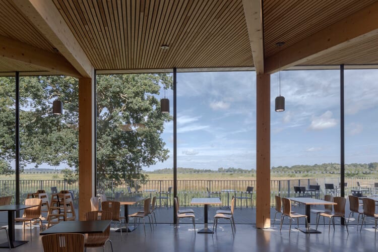
Image: © Peter Cook (archdaily.com)
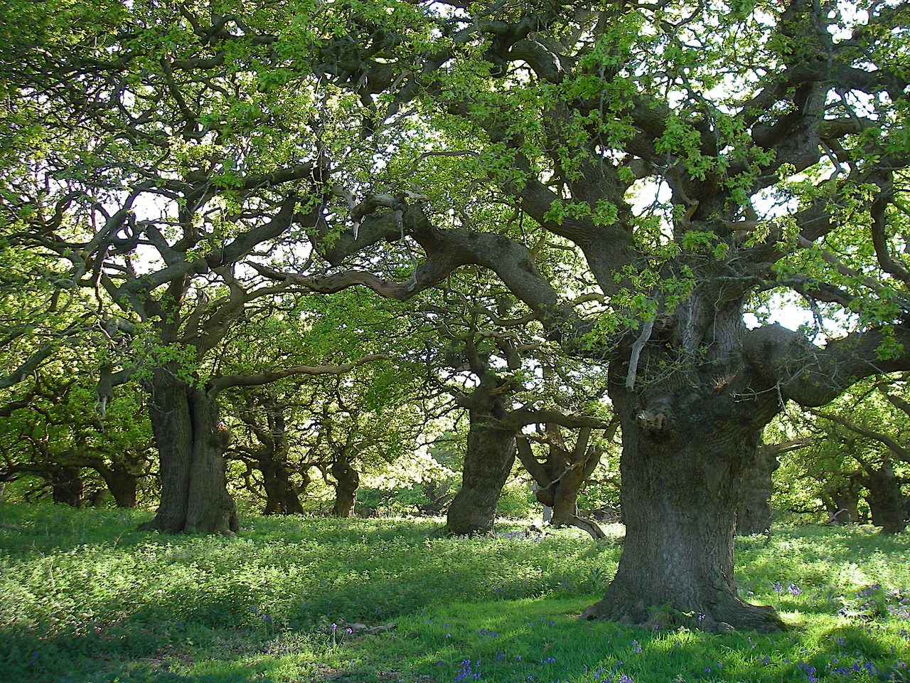
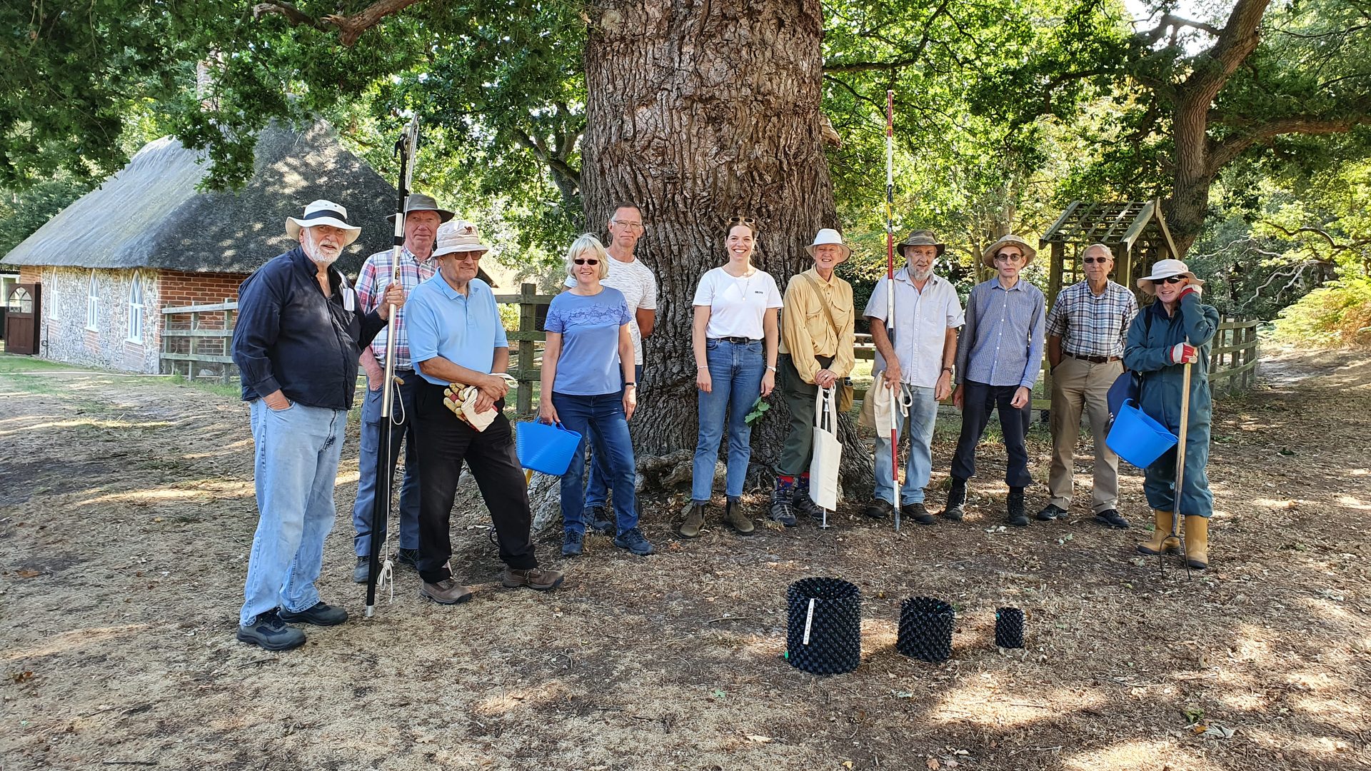
Mighty Oaks of Staverton
Tom Fairbrother, Coast & Heaths AONB
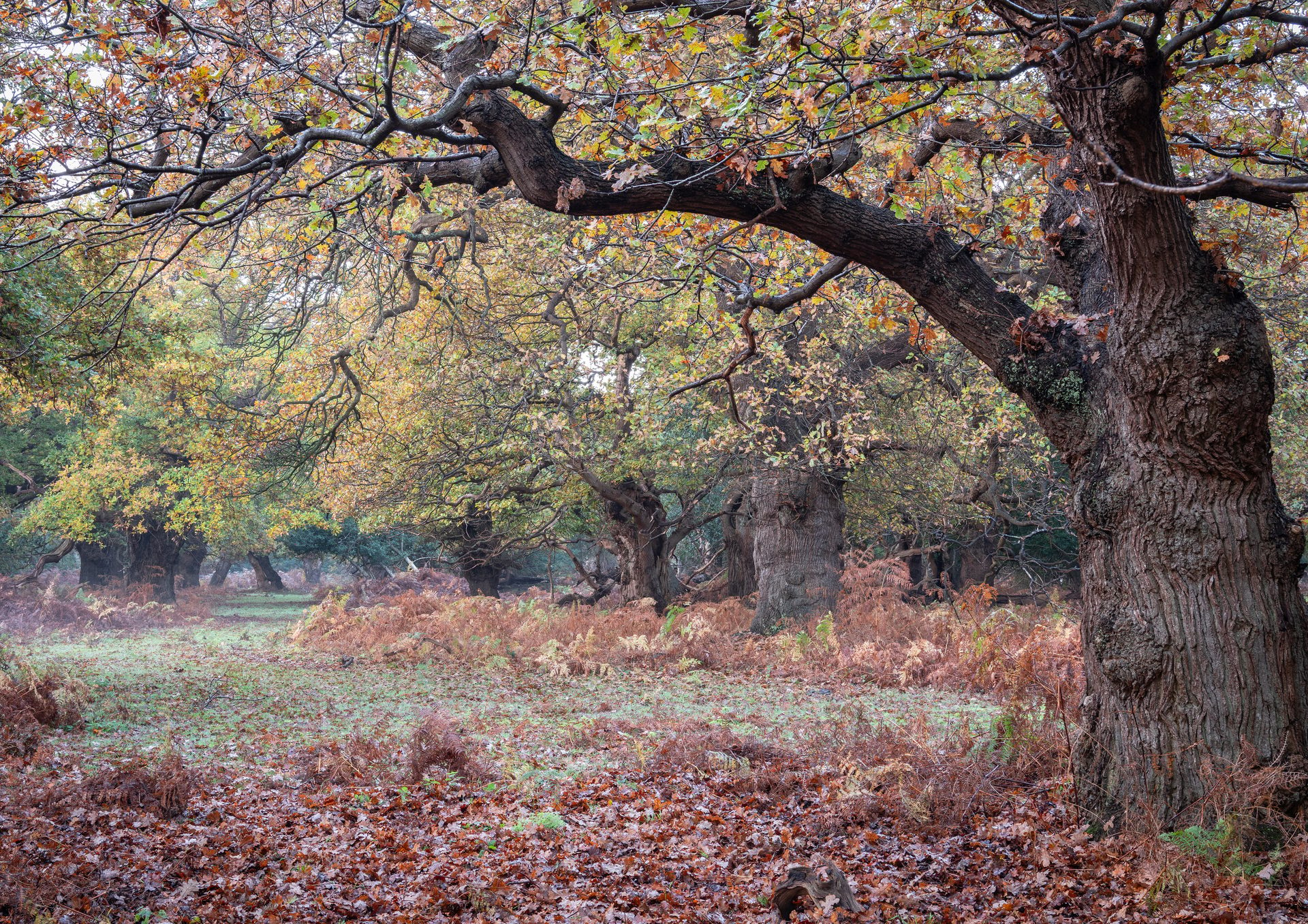
Image: Gill Moon
Since 2019, the Coast & Heaths Area of Outstanding Natural Beauty (AONB) has been organising work parties at Staverton Park and Thicks, working alongside Suffolk County Council’s Woodland Advisor, Gary Battell.
Staverton Park and The Thicks, Wantisden, is an 80-acre Site of Special Scientific Interest (SSSI) and Special Area of Conservation (SAC). The site is representative of old acidophilous oak wood in the eastern part of its range, and its ancient oaks Quercus spp. have rich invertebrate and epiphytic lichen assemblages.
Despite being in the most ‘continental’ part of southern Britain, the epiphytic lichen flora of this site includes rare and Atlantic species, such as Haemotomma elatinum, Lecidea cinnabarina, Thelotrema lepadinum, Graphis elegans and Stenocybe septata.
The site has a very well-documented history and good conservation of woodland structure and function. The ancient Park is woodland on sandy soil, with mature pollard oaks, while The Thicks is a dense wood with hollies, some of them thought to be the largest in Britain.
Volunteers have collected acorns, some of which were successfully grown on to the small sapling stage. Early in 2022, exclusion compartments were built, into which the young trees were planted. The compartments aim to keep out cattle and deer and allow the natural regeneration of oak trees. By 2020 natural oak regeneration had dropped to very low levels.
In October 2020, acorn collecting proved an extremely wet introduction to our efforts at the site! All those involved ended up soaked, but bags full of acorns were gathered. Some acorns were potted up into ‘modules’ using sterile, peat-free soil and grown on. Some were sent to Hollesley Bay Prison and potted up but unfortunately fell victim to small mammals.
Gary had an unexpected bonus on acorn collecting day when we bumped into George Peterken and members of his family. George Peterken is a woodland ecologist who, as part of the Chief Scientist’s team in the Nature Conservancy Council (now Natural England), led the development of national surveys of woodland and their management for nature conservation.
Covid, by and large, put a stop to all activity from late 2020 to early 2022. However, in late January this year, the volunteers returned to build animal ‘exclosures’. They constructed triangular guards for individual trees and rectangular ‘Gen Guards’ for multiple trees. Metal ‘Rebar’ was used to support metal weldmesh for both designs. Early signs are that the structures are doing their job well.
In September 2022, activity resumes with another acorn collecting session, followed by the chance to get hands dirty ‘potting up’! The work at this stunning, awe-inspiring site has proved popular with the AONB Volunteers. We have such an enthusiastic group, full of (pleasant!) banter. Huge thanks to each and every one of them.
Volunteers play an essential role in helping to conserve and enhance the Coast & Heaths AONB. Giving their time enables the AONB (and other organisations and landowners) to carry out important work that wouldn’t otherwise be possible and help the nationally important protected landscape.
But it’s not just our special area that benefits – the volunteers also reap the rewards of spending time outside in the AONB. In addition to the physical benefits of getting active and the different manual tasks, volunteering is a brilliant way to boost well-being and mental health through socialising, learning new skills and making a positive difference to the local environment.
Everyone is welcome to take part, and we are always looking for new volunteers of all ages and levels of experience and skill. There are a wide range of activities on offer, including practical conservation work out in the field, monitoring our coast and estuaries, checking popular recreation routes, removing plastic guards from trees and cleaning beaches.
No previous experience is required. For more information about volunteering with the AONB, please visit suffolk coast and heaths.
Neil Lister, Countryside Projects Officer, Coast & Heaths AONB,
Gary Battell, Woodland Advisor, Suffolk County Council.
The Suffolk Water Crisis
Andy Went, Essex and Suffolk Rivers Trust
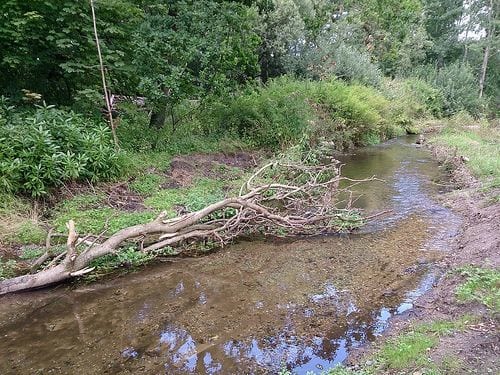
Image: A low flowing channel,
Essex and Suffolk Rivers Trust
Suffolk river catchments flow through some of the driest regions in the UK, and this year’s dry weather conditions are bringing home the importance of water to our region. As a result, we face the issues of water availability and sustainable use both now and in the future.
We live in an area that can experience both flash floods and severe shortages of water. Research predicts that demand from all sectors will grow whilst the availability and reliability of water supply is likely to become far less predictable and more challenging to manage due to climate change. Many scientists and experts in the water resources industry believe we are already experiencing a crisis with the supplies for Suffolk, which recent weather patterns can only reinforce. The UK Climate Prediction 2009 made a bold statement saying that river catchments in the UK are likely to have 39% less rainfall in the summer by 2100, reducing river flows by a predicted 80%, whilst winter rainfall will be 35% more, increasing current winter flows by 35%. These figures have enormous implications for seasonal water availability, flooding and abstraction for all water users and the environment.
The Rivers Trusts, Water Resources East, the Environment Agency, and Suffolk County Council water resources have put planning for the future high on their agendas. We at the Essex and Suffolk Rivers Trust are delivering the Water for Tomorrow project for the East Suffolk Water Resources Priority Catchment through the East Suffolk Catchment Partnership, working on a local catchment-based approach. This programme aims to work with water users and regulators to implement new and innovative solutions to help manage the water resource situation locally. Suffolk County Council is also working on water resilience projects with Reclaim the Rain, which aims to help alleviate similar issues within three parishes in Suffolk.
All water resources organisations, whether representing agriculture, the environment or water supply and demand, understand that there is a predicted water shortage in our area and that they need to implement plans and actions urgently. The impending water shortages are why stakeholders from all interests are working closely with Water Resource East to develop a water resources plan for the East.
For many years now, experts have predicted the impacts of climate change and increasing global temperatures, and year-on-year, evidence is mounting that some of those impacts are happening now. Things are likely to get worse, with potentially alarming consequences, if we do not do more to both mitigate and adapt in our region. Thinking now about how to protect the environment, businesses and abstractors, which are the things that are highly likely to be impacted by water shortages, are vital for ensuring resilience.
Follow the links for further information on Water for Tomorrow or Reclaim the Rain.
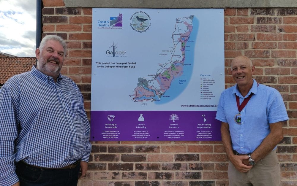
Wind farm funds community projects in Leiston and Sizewell
Tom Fairbrother, Coast & Heaths AONB
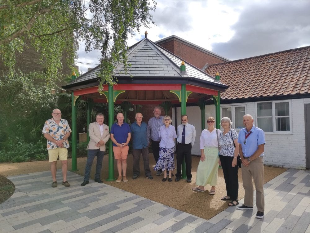
Leiston Community Garden volunteers
The Coast & Heaths Area of Outstanding Natural Beauty (AONB) Galloper Wind Farm Fund had warded more than £11,000 of funding to community projects in Leiston and Sizewell.
The Fund, which supports projects that contribute to the appearance, setting, conservation, amenity, accessibility, and enjoyment of the area within a 5km radius of the Galloper substation, has awarded six projects a combined total of £11,350 for the 2022/23 funding year.
- The most significant award was to the Suffolk Wildlife Trust, which will use the funds to train six local teaching staff to enable them to run outdoor, marine-based learning activities for children at their schools.
- The 1st Leiston Scout Group received over £2,000 to upgrade the 20-year-old heating system of the Scout Hut.
- The Royal British Legion Band received funding to refurbish the Ex-Service Club in Leiston. The building, which has fallen into a state of disrepair, will be renovated with new insulation and lighting to turn the building into a usable community hub.
- The Fund provided a grant for a new Creative Curve heritage project focused on supporting and preserving common land known as ‘The Fens’ between Aldringham and Thorpeness. This project promotes engagement with and production of a sculptural interpretation and community panel on The Fens, which has an SSSI designation and a well-used footpath network.
- Leiston Community Land Trust received £2,000 for the Leiston Church Square Community Garden project. This grant award supports a Project Manager role to coordinate community events and activities, a cycle rack, an interpretation board, and new garden equipment.
- Alde Valley Academy received funding for a new SEND sensory and vegetable garden for SEND students (with Special Educational Needs and Disabilities) to allow them to grow vegetables and complete hands-on activities in the fresh air.
Sean Chenery, General Manager at Galloper Offshore Wind Farm, said: “We are delighted our community funds can provide financial assistance where it can make a difference to the day-to-day life of the communities that neighbour our substation.
“The current economic climate has resulted in many community groups struggling to access grant funding, which makes locally managed funds like these even more valuable to communities. I would urge other groups in the area who could benefit from some funding to consider making an application to the AONB fund.”
The Fund is held by Suffolk County Council and administered by Coast & Heaths AONB on behalf of Galloper Wind Farm Ltd.
You can learn more about the Galloper Wind Farm Fund and the AONB’s grants programmes by following the link.

Ipswich proud to achieve ‘Tree City of the World’ status
Sarah Kilshaw, Ipswich Tree Warden Network
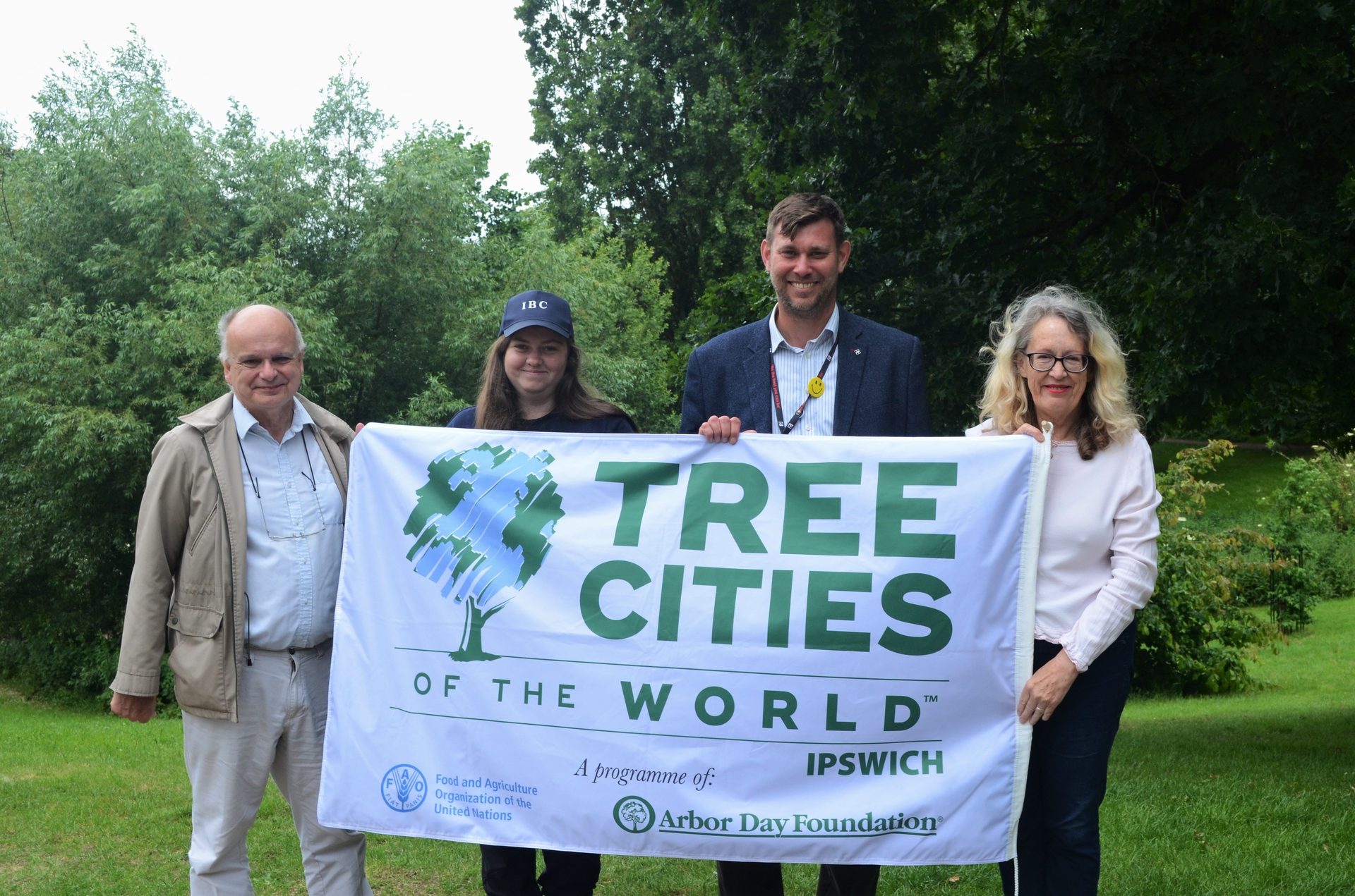
Earlier this year, Ipswich Borough Council received the fantastic news that The Arbor Day Foundation had recognised Ipswich as a Tree City of the World. The town is the first in East Anglia and one of only 19 in the UK to achieve the accolade.
This international award celebrates 138 towns and cities globally, all places dedicated to urban forestry, a transparent approach to increasing and protecting tree cover, and engaging communities in tree planting and management.
Ipswich Borough Council has stepped up its effort to enhance tree care in the last year.
- They formed a dedicated Ipswich Tree Board with experts from the council and local wildlife groups.
- The Ipswich Tree Charter has been created and outlines the council’s promise to trees in the town.
- The parks department worked with The Greenways Project and Ipswich Wildlife Group to sustainably turn extracted Corsican Pine into wildlife homes at Bridge Wood (a project to thin Corsican Pine and restore the woodland to broadleaf woodland of higher wildlife value).
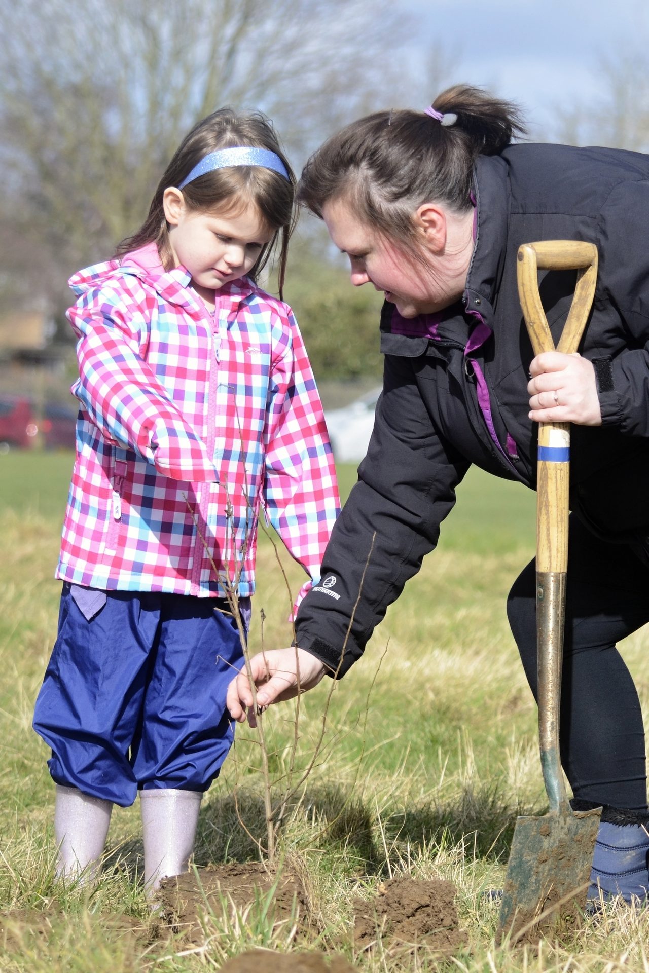
Ipswich held several new tree planting events, with around 3,000 trees planted as part of Ipswich Loves Trees Day (14 February) and Ipswich Loves Trees Week (February half-term). In addition, funding from the Urban Tree Challenge Fund and Treescapes Fund boosted tree projects across the town. In particular, it helped Ravenswood Wildlife Group to plant a new community orchard at Braziers Wood and Meadow, added 100 trees to parks, and created five new “Miyawaki Woodlands” – where seedlings are planted at high densities to replicate the natural regeneration process.
Following the Tree City of the World status announcement, the council partnered with The Tree Council and Suffolk Tree Warden Network to launch a new volunteer scheme, the Ipswich Tree Warden Network. This scheme aims to bring together people passionate about preserving trees and looking after the environment to help grow, plant, manage and engage the people of Ipswich in tree care.
They have designed the tree warden scheme to be flexible, allowing people to offer whatever time they can spare. Activities can be as simple as potting up and growing on self-sown trees in their garden, attending tree planting events or, if time allows, organising community events or working with local schools. Ipswich Tree Warden Network is finding ways to support the projects people would like to be involved with, whatever their level of passion.
If you are interested in becoming a tree warden, visit www.ipswich.gov.uk to find out more, email [email protected] or call the team on 01473 433998.
Volunteering in the Coast & Heaths Area of Outstanding Natural Beauty
Tom Fairbrother, Coast & Heaths AONB
Volunteers helping out in the AONB
The Coast & Heaths Area of Outstanding Natural Beauty (AONB) is looking for volunteers to help with practical conservation work on Tuesdays from November 2022 – March 2023 after the new schedule for autumn and winter was published.
Volunteers can work for as long as they wish and at their own pace. Prior knowledge of the landscape, heritage, wildlife, and conservation is optional, as we provide all the necessary training on the day.
AONB volunteers regularly undertake practical conservation work. If you would like to work outdoors in the beautiful Coast & Heaths, help your local environment and meet some new people, then why not join us?
Volunteers sometimes work on projects with community and corporate volunteers, and you may find yourself working alongside those groups. We can also offer training, for example in first aid, should you be interested.
Volunteering tasks occur in several locations across the Coast & Heaths Area of Outstanding Natural Beauty. 2022-23 include Tunstall, Southwold, Wenhaston, Blaxhall and Dodnash.
For more information on volunteering opportunities and roles within the Coast & Heaths Area of Outstanding Natural Beauty, please get in touch with Countryside Project Officer Neil Lister. Most tasks start at 9.30 am and finish at 3.00 pm.
You can find out more about our work parties here.
Riparian Tree Planting in Suffolk
Naomi Boyle, Environment Agency
The Environment Agency will carry out some riparian tree planting this winter in Suffolk. This work is mitigation for any trees we have had to remove as part of our routine flood defence maintenance works. i.e. river conveyance management.
This year, planting sites are concentrated along the River Fynn, which we identified as a watercourse that could benefit from riparian tree planting to provide shade to control in-channel vegetation growth. Other benefits of riparian tree planting include moderating extremes in river temperature, important for climate change mitigation and providing physical habitat diversity that, in turn, supports a diverse range of animal and plant species. Riparian tree planting also helps stabilise river banks to reduce erosion and sedimentation, which negatively impacts water quality and available habitat for invertebrates and spawning fish such as trout.
We expect funds will also be available for winter planting during 2023–4. So if you are a landowner alongside one of the main rivers in Suffolk and are interested in the potential benefits of tree planting, then please do get in touch with Naomi Boyle, Catchment Co-ordinator for Suffolk [email protected] to find out more about this project.

Events
Conferences, Webinars & Training
Suffolk Naturalists’ Society 2023 Conference
Into the Wild • 4 & 11 March 2023 (two half day sessions) • Online • sns.org.uk
National Biodiversity Network Conference
9 Nov • Natural History Museum, London • nbn.org.uk
British Ecological Society
BES Annual Meeting 2022 • 18 – 21 Dec 2022 • Edinburgh International Conference Centre • www.britishecologicalsociety.org
RSK Webinars
The First Thursday Club is a monthly scientific, specialist-led webinar created and led by RSK Biocensus, which focuses on best practices relating to the natural environment. Previous First Thursday Club Webinars are available on YouTube
Tree and Design Action GrouP
Understanding the value and fragility of ‘soil’ • 7 Dec 2022 • online • www.tdag.org.uk/events.html. Presentation notes from previous events, guides and case studies can be found on their website: www.tdag.org.uk
Suffolk Wildlife Trust
- Wildlife Live Webinar - Bats of Suffolk • 3 Nov • Online
- Celebrating conifers • 16 Nov • Bradfield Woods
- Wildlife Live Webinar - Wildlife Ponds • 16 Nov • Online
- Wildlife Live Webinar - Slugs • 28 Nov • Online
- Bird ID at Lackford Lakes • 4 Dec • Lackford Lakes
- Wildlife Live Webinar - Planting for pollinators • 5 Dec • Online
- Wildlife Live Webinar - Natural reflections • 12 Dec • Online
- Botanical Drawing and Painting • 9 Jan 2023 • Carlton Marshes
See all SWT events
Field Studies Council
River Waveney Trust
Regenerative Agriculture & Communities • 17 Nov • Bungay Community Centre
www.riverwaveneytrust.org/events
The Species Recovery Trust
Online courses
- Habitat Indicator Species • 7 Nov
- Around Britain in 25 sedges • 14 Nov
- UK Wildlife & The Law • 21 Nov
- Great Crested Newts: Ecology, Conservation & Survey • 28 Nov
- Winter Tree ID 2022 • 9 Dec
- Around Britain in 25 grasses • 16 Jan
- Around Britain in 30 Bryophytes • 23 Jan
- Around Britain in 20 ferns and their allies • 30 Jan
- Around Britain in 25 Rushes • 1 Feb
- How to survey and assess hedgerows • 6 Feb
- Grasses Part 2 • 9 Feb
- UK Habitat Classification • 20 Feb
- Heathlands and acid grassland - Species and habitat survey • 23 Feb
- Aquatic Plant ID • 27 Feb
London Natural History Society
- Saving Britain’s Curlews • 3 Nov
- Wet, dry and wilder? • 10 Nov
- The Peregrine: Ecology and Biology & LBC AGM • 17 Nov
Field Studies Council
Year End Book Sale
With 25% off lots of titles, now is a fantastic time to stock up your library of field guides! Head over to the FSC website to view their offer items.