Autumn 2024
Newsletter

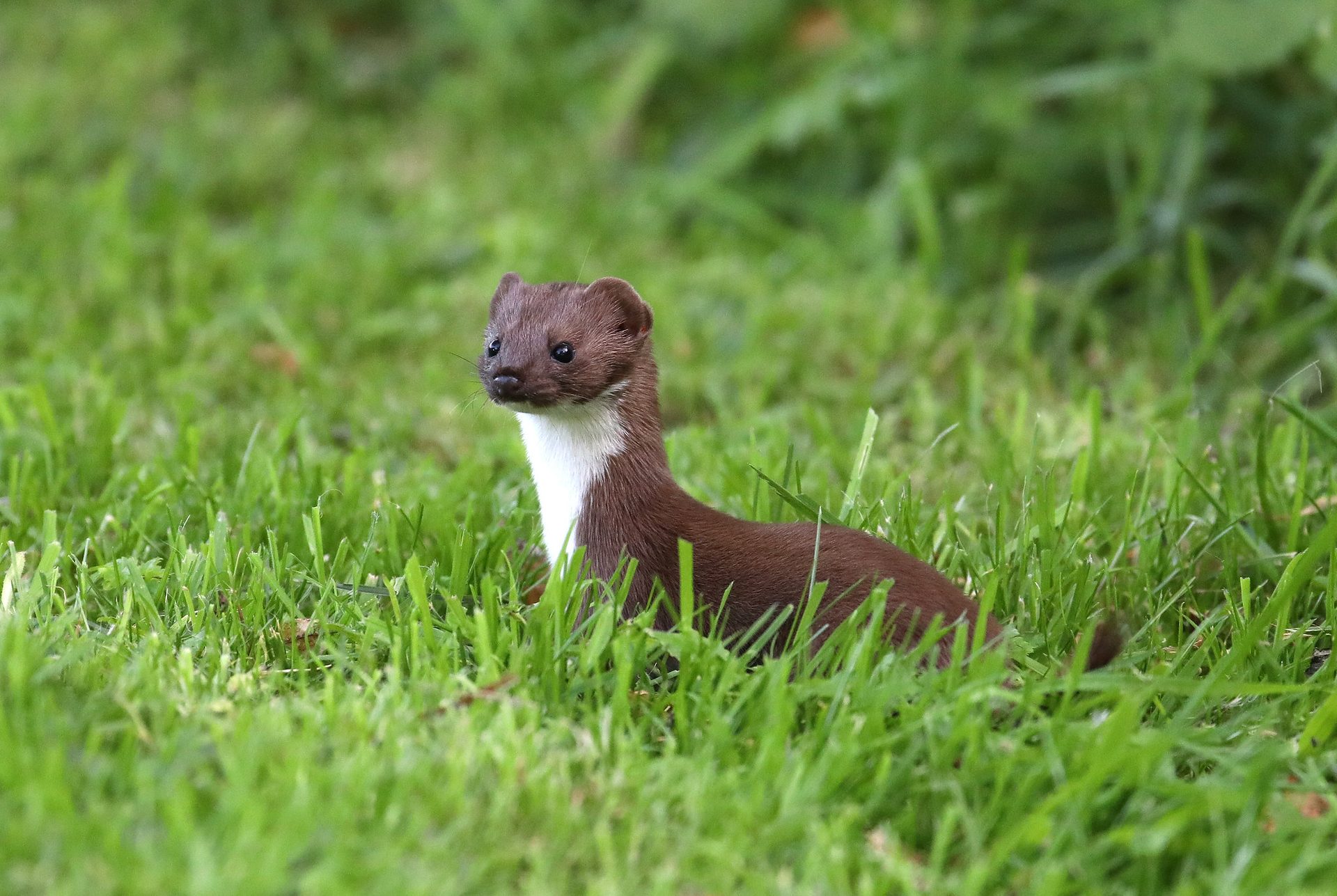
Weasel at Thurston. September 2023, with thanks to Trevor Goodfellow
SBIS News
Projects
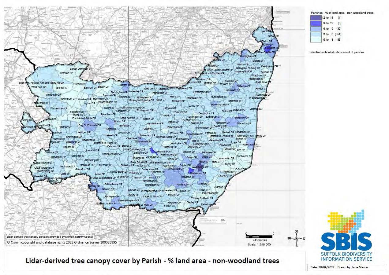
Lidar-derived tree canopy polygon data
Hedgerows
Data generated for hedgerows is now available on our website (www.suffolkbis.org.uk/hedgerow); this includes data on area, height, estimated volume and the total number of tree canopies. We have mapped these quality indicators at parish level and these can be requested free of charge – see examples of the maps we can provide on our website. Additionally, data is available in GIS format for download.
County Wildlife Sites, Roadside Nature Reserves, County GeoSites
Suffolk Wildlife Trust continues to rewrite many CWS citations, which are being incorporated into our database. Boundaries at Hawstead Village Green and Laurel Cottage CWS have been extended and a new CWS at Beyton Churchard has been designated.
Data updates to SLA Partners
The 6-monthly GIS data updates were made available on the SBIS website in May. For those who download the data, notification emails including the download links were sent out. The next updates will be in November.
Native Black Poplar Survey recording form and map
This is live and accessible via a link on the SBIS website to registered volunteers and Suffolk Tree Wardens.
The planted sapling data is now included as a layer on the map, and volunteers are adding new records to this and verifying existing trees. Records of new trees are sent to the Native Black Poplar Recorder, Sue Hooton, to verify.
Other activity
Ancient Woodland Inventory Update
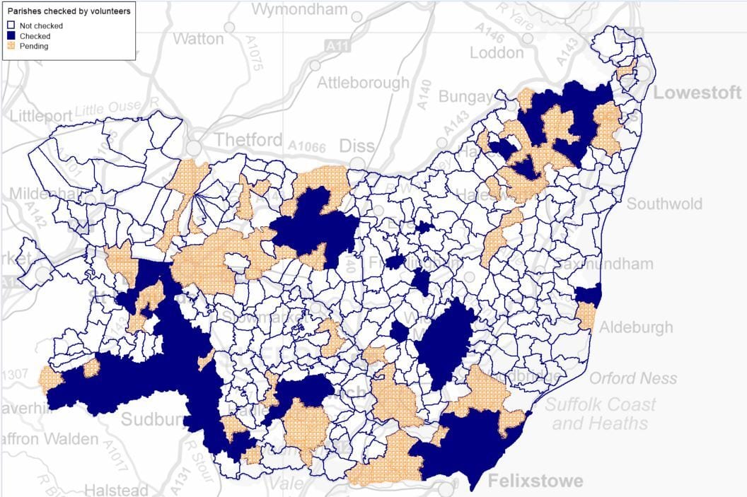
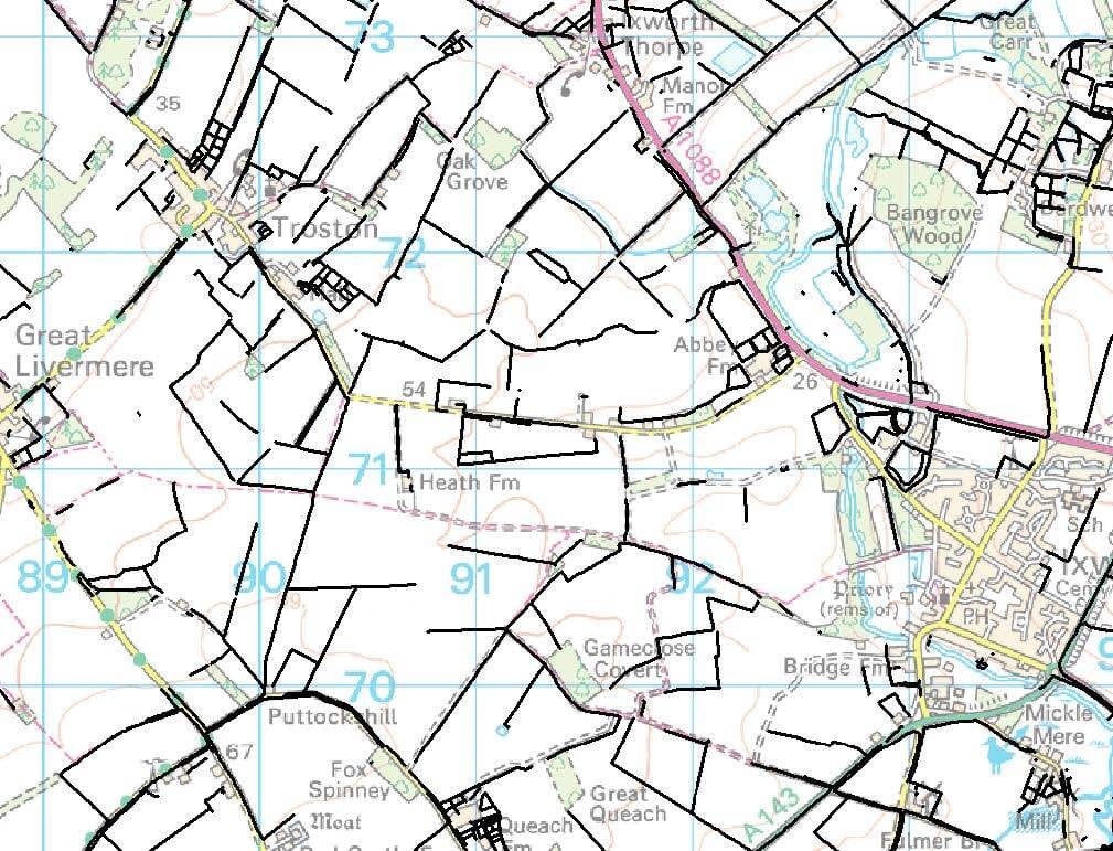
SBIS continues to work on the Ancient Woodland Inventory update which commenced in November 2021 for Suffolk. The project is now in Phase 3 of 4, with the main focus on checking potential new ancient woodland or pasture and parkland sites on historic maps dating back as far as 1600. SBIS currently has 19 volunteers checking sites on three Ordnance Survey maps spanning 1800 – 1900, a fruitful effort which has, at the time of writing, covered 36% of the county in one month (see map).
Number of searches and records processed from January to June 2023
Commercial Data Enquiries
For the first ten months of 2023, we have processed 501 searches Supplying 599,216 records. The equivalent of 12 searches a week with an average of 1,196 records each. This is an increase of 1 search and 117,733 records from the same period last year.
© Crown copyright and database rights 2023 Ordnance Survey 100023395
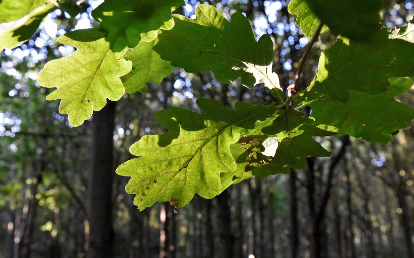
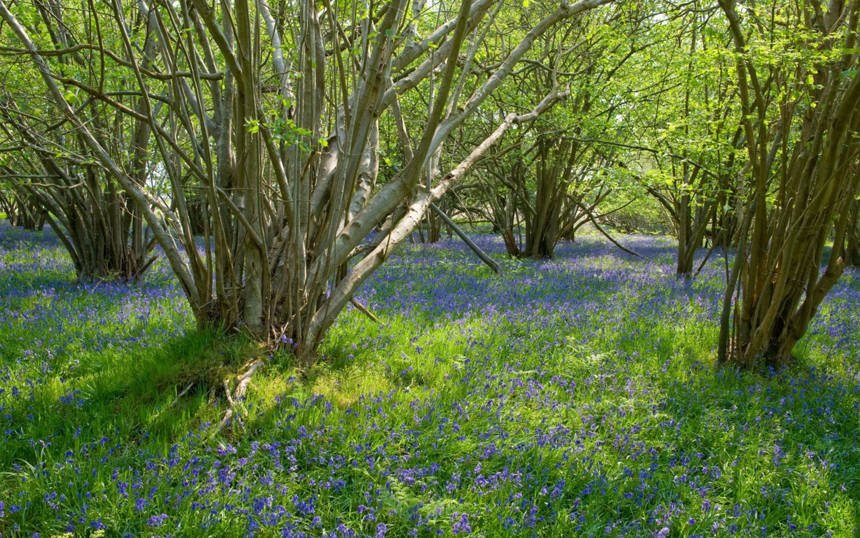
Discover Suffolk’s Hedgerows
Emma Aldous, SBIS
Suffolk is a largely rural county, and in our rich and varied agrarian landscape, hedges are deeply significant monuments of land use and farming practice. As field boundaries, hedges can be of great antiquity.
Francis Pryor’s meticulous excavations at Flag Fen in Cambridgeshire peeled back the overlying peat to reveal Bronze Age farms with rectilinear fields bounded by ditch and bank, certainly with a thorn hedge on top. Later, at Yaxley, Norman Scarfe showed how Roman roads can cut obliquely and uncomfortably through a pre-existing hedged landscape. Here, the rectangular field system survives to this day, established by our Iceni predecessors who farmed this land.
Rich in conservation value, ancient hedgerows support an extensive diversity of plants and animals. Species-rich hedgerows, those averaging five or more native woody species per 30-metre length, are generally recognised to be likely to have existed before the Enclosure Acts of 1720-1840. A notable finding of the remarkable Suffolk Hedgerow Survey 1998-2012 is that, in Suffolk, 20,179 landscape hedges (52.7% of those surveyed) comprise eight or more woody species and 11,940 (31.2%) others contained 5–7 species: a sum of 32,119 hedges (83.9%) that are probably at least three and possibly twenty centuries in age.
Trees, hedgerows and woodlands supply multi-functional benefits. They are one of the most significant sources of natural capital, providing oxygen, combating climate change, reducing flood risk, slowing rainwater run-off, and providing food for people and wildlife. In addition, they form a crucial refuge for many of our native species and a great pollen and nectar source for insects.
Their importance makes protecting them vital. Understanding the extent and quality of the existing hedgerow network is invaluable in helping to shape conservation and management plans, especially given the challenges of increasing habitat fragmentation.
SBIS has just launched a new hedgerow portal where you’ll find maps and data on Suffolk’s hedgerows, information on hedgerows as a Priority Habitat, and the Suffolk Hedgerows Survey. We have also discovered links to other valuable articles and resources and shared them.
The new maps result from an extended project and provide essential details for research, conservation and sustainable management of our wildlife and habitats. Showing how connected and interconnected hedgerow areas are will help management plans to focus on protecting isolated populations.
Creating the maps
The Environment Agency captured surface height data for Norfolk and Suffolk between 2017 and 2020 using Light Detection and Ranging (LIDAR) equipment fitted to a survey aircraft.
Norfolk County Council wrote an algorithm to identify and extract tree canopies from this data and then created GIS polygons showing the extent of individual tree and hedge plant crowns of at least 2m in height (though it should be noted that a single tree may have several crowns).
The resulting data covers Norfolk and Suffolk and is viewable on the Norfolk County Council website.
Using this data, we began a project to translate it into a series of comprehensive maps.
The first task was to remove errors in the data. The original GIS polygons included some with heights up to 125m tall, which proved to be objects such as cranes, pylons and towers.
The tallest recorded trees in Suffolk, Giant Redwoods, are less than 40m high, so we could safely remove all objects over 50m. Next, by comparing the data with the Ordnance Survey’s MasterMap layer and aerial photography, we found and removed polygons which were incorrectly identified as trees (for example, vehicles and bridges). Cleaning the data gave a more accurate foundation to work from.
Once confident that most of the remaining polygons represented trees, we labelled them by parish name. We compared the polygons with OS MasterMap data to identify which tree category they belonged to (woodland conifer, woodland broadleaf, scrub or non-woodland trees) and added the relevant label. Afterwards, we used this data to produce a series of maps showing the percentage and types of tree cover across Suffolk by parish.
County-wide PDF tree cover maps by parish
- Density of tree canopy
- Density of woodland broadleaf tree
- Density of woodland conifer trees
- Density of non-woodland trees
- Density of scrub trees
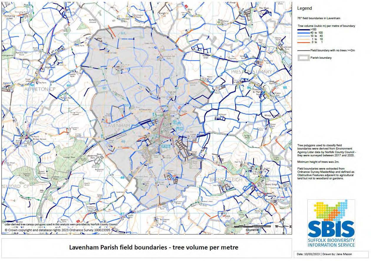
With the tree data mapped, the project began the second phase, analysing the data to create a snapshot of hedgerow quality in Suffolk. We extracted agricultural field boundaries (hedges) from OS MasterMap data, ensuring that garden hedges, woodland edges, and non-agricultural land boundaries were excluded to create a base layer to work from.
With that done, we overlaid the GIS tree polygons onto the extracted hedge lines and calculated a range of statistics for each hedge. The statistics included parameters such as gappiness, average height and volume. With this new data added to the hedge layer, we could create a series of maps to illustrate the calculated statistics.
County-wide PDF maps of hedgerow quality
- Percentage of land area which is hedge tree canopy
- Percentage of non-woodland tree canopy that is hedge trees
- Percentage of total boundary length that has no trees
- Percentage of total boundary length that has trees
- Percentage of tree canopy that is hedge trees
- Density of field boundaries
- Mean percentage of boundary that is gap
- Mean percentage of boundary that has trees
- Mean height of treed lengths
- Mean total tree volume
- Mean tree volume per metre
- Mean variation in tree height
SBIS has created sample parish maps for Lavenham and Knodishall, which can be downloaded from the SBIS website. More parishes will be added over the coming months. Maps for other Suffolk parishes can be requested by emailing [email protected].
Parish-specific PDF maps of hedgerow quality
- Mean percentage of boundary which has trees or gaps
- Mean percentage of boundary which is treed
- Mean height of treed lengths
- Mean total tree volume
- Mean tree volume per metre
- Mean variation in tree height
If you have GIS mapping software, you can download the complete GIS datasets from the SBIS website.
TAB or SHP format GIS datasets:
- Hedgerows cut by Parish boundaries
- Hedgerows cut by Parish boundaries with gaps and treed sections
- Suffolk Parishes with hedgerow information
- Hedgerows, whole
- Hedgerows, whole - gaps and treed sections
- Tree canopy polygons cut by Parish boundaries*
- Suffolk Parishes with tree canopy information
- Tree canopy polygons, whole*
- Hedge tree polygons
* These very large datasets are not available in Excel or Shapefile formats. Please download in TAB format and translate
This data forms a valuable reference for those working to promote and safeguard Suffolk’s natural heritage in areas including tree and hedge planting, ecological research, conservation and planning.
Historic Mapping of Ancient Woodland
Research Volunteers Wanted
This is an exciting opportunity to find potentially new Ancient Woodland sites across Suffolk that were previously unidentified and, therefore, not registered on the Ancient Woodland Inventory (AWI).
You will be working solo, on a desk-based project which can be undertaken from home; it will require access to Microsoft Excel and the internet. Support and guidance will only be an email away! Helping to identify these Ancient Woodland sites will further evidence the need for protection and conservation, preserving Suffolk historic landscape.
You will receive a list of potential new Ancient Woodland sites for a parish (or parishes) of your choice to check against three historical Ordnance Survey maps which are available to view for free on the National Library of Scotland website. You will indicate on which source each woodland appears and if the boundaries of the site appear to have changed over time, completing this information in the spreadsheet and returning it to be incorporated in the projects data which shall be submitted to Natural England. Once completed, this dataset will go on to be published and publicly available; its required use in the National Planning Policy Framework will help to protect this ancient asset from future development.
Tasks and responsibilities
Checking data bases against maps • Using Excel • Reading maps
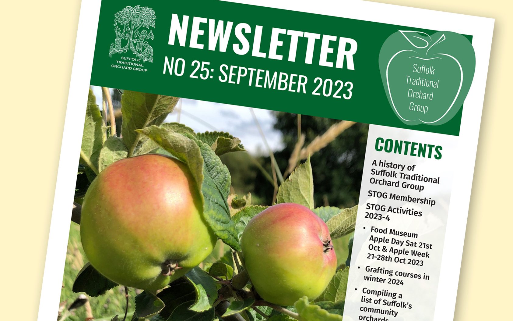
Suffolk Traditional Orchard Group Newsletter
The latest STOG newsletter is available now on the SBIS website
Contents
A history of Suffolk Traditional Orchard Group
STOG Membership and Newsletter
STOG Activities 2023-4
- Food Museum Apple Day Sat 21st Oct & Apple Week 21-28th Oct 2023
- Grafting courses in winter 2024
- Compiling a list of Suffolk’s community orchards
- ONCA Project... Will the real Malus sylvestris please stand up!
- Publishing the OE Orchard Biodiversity Project Report
- Disentangling mirabelles, myrobalans and cherry plums for a new Advice Note
Is 2023 the worst apple crop ever?
Recently available books
Monica’s recipe for October 2023
STOG Advice Notes
Practical Actions for Orchard Communities
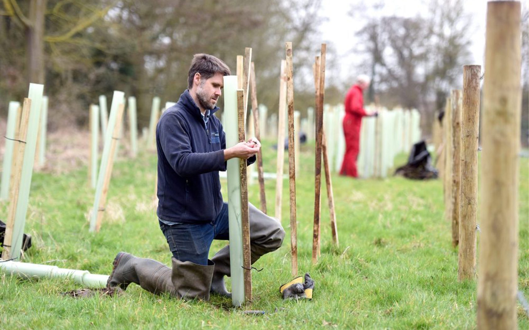
New volunteering opportunities for nature lovers
Tom Fairbrother, Coast and Heaths AONB
Tree planting in action © Gregg Brown
A range of exciting volunteering opportunities are now available for people with a passion for nature, the environment, and getting stuck in in their local area.
The Coast & Heaths Area of Outstanding Natural Beauty is looking for volunteers to help with practical conservation work on Tuesdays and Friday from October 2023 – March 2024.
Working in groups of like-minded people, volunteers regularly undertake a range of hands-on tasks, including tree planting, clearing gorse, creating habitats for wildlife, cleaning beaches, and much more.
Tasks take place in different environments across the Suffolk coast, including Aldeburgh, Shotley, Trimley, Pin Mill, Southwold and Waldringfield, working in woodlands, heathland to beaches.
Volunteers can work for as long as they wish and at their own pace. No previous experience is required and all training and equipment is provided on the day. It’s a great way to meet new people, improve your physical health and mental wellbeing.
Work carried out by volunteers also plays a vital role in supporting nature and wildlife by creating new habitats, promoting biodiversity, and removing harmful plastic from the natural environment.
For more information on any of the volunteering opportunities and roles within the Coast & Heaths Area of Outstanding Natural Beauty, please contact Countryside Project Officer, Neil Lister, at [email protected]
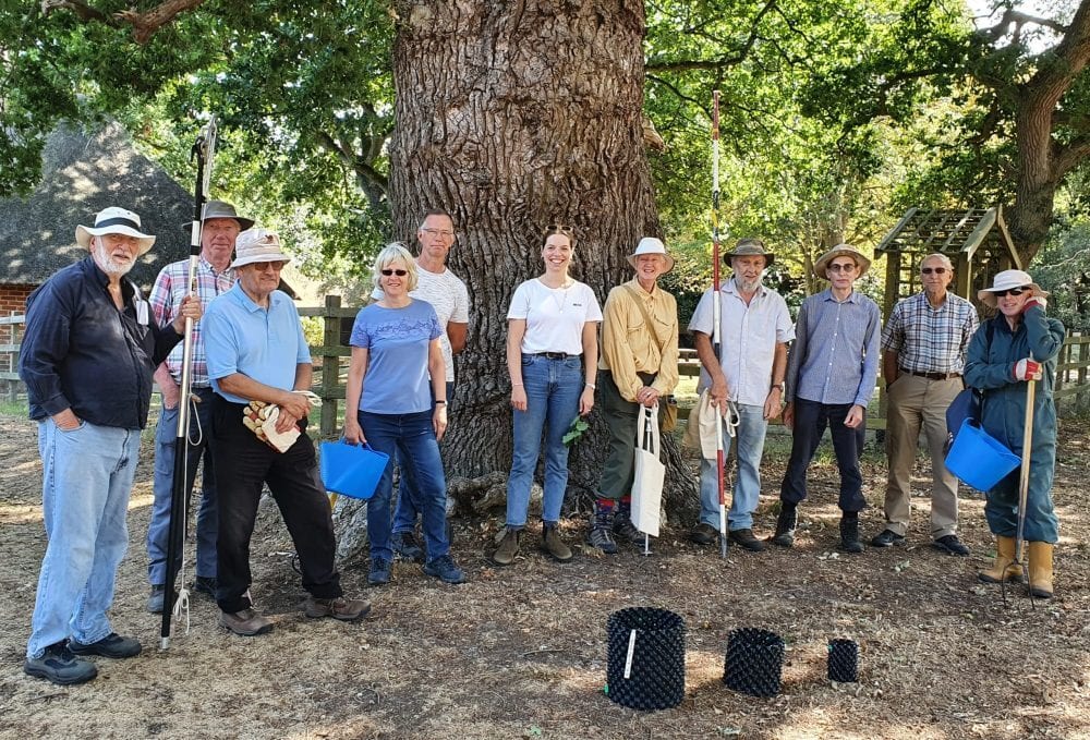
Volunteers at Staverton © AONB team
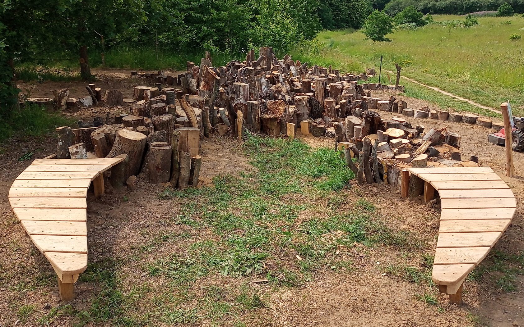
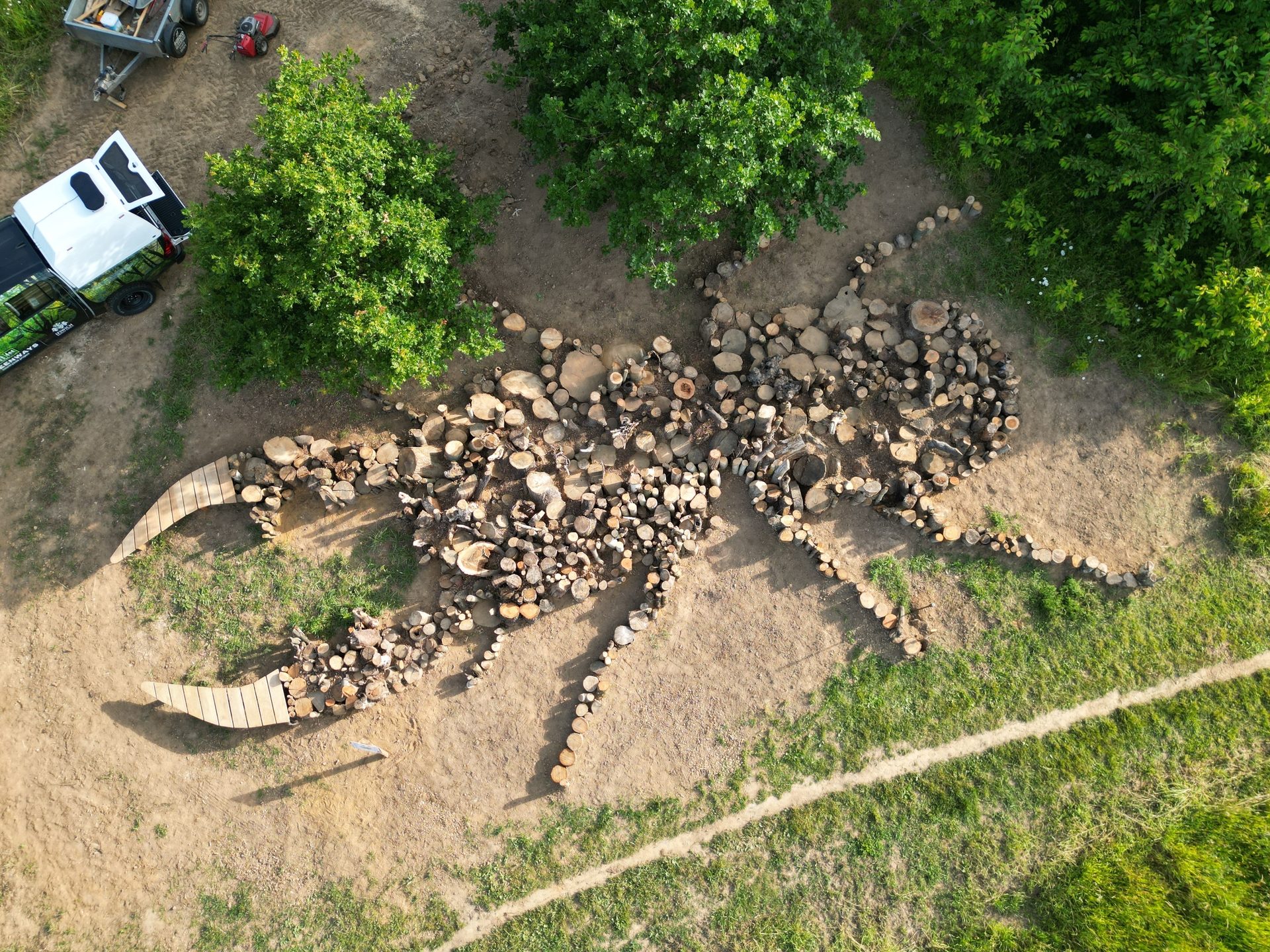
Giant Stag Beetle habitat sculpture completed
James Baker, Greenways Countryside Project Manager
At more than 15 metres long, the ‘pile’ is large enough to be visible from satellite maps in the future and will help generate interest in this fascinating species. It may be the largest stag beetle habitat pile in the world!
The Greenways Project volunteers worked alongside Suffolk Wildlife Trust young members, the Friends of Belstead Brook Park and other volunteers – who helped to dig out parts of the shape and placed over 25 tonnes of logs into the right places. A digger was used to rough out the main hole, but a considerable effort was still required manually to complete the design.
The front of the ‘antlers’ have been built as seats (all made from our own locally sourced oak and sweet chestnut timber, for longevity), so that local people visiting the structure are encouraged to stay and enjoy it, the wildlife it attracts and the rather lovely setting of Kiln Meadow and Spring Wood Locals.
As with most habitat piles, this one will not only benefit stag beetles, but hundreds of other species too – other invertebrates, hibernation places for reptiles and amphibians, cover for small mammals, food for passing birds and home for the fungi that will break down the wood.
The other main purpose of the sculpture is to promote the importance of this species in the Ipswich area and to encourage people to create their own buried log piles in their gardens etc. We know from previous experience that even a single log buried in the ground can be enough to attract stag beetles. Just imagine if every garden, green space, park and allotment had some buried wood – the current scarcity of this magnificent insect could be turned around very quickly!
Boosting Suffolk’s canopy cover, one parish at a time
Kelda McChesney, Assistant Tree and Woodland Officer, Suffolk County Council
Robert Read / WTML
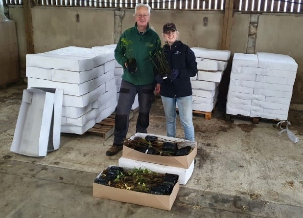
The Suffolk Tree Warden Network is back for a sixth year in a row, offering over 5,000 free trees and 6,000 metres of hedgerow to tree wardens this winter. They are committed to the Right Tree: Right Place: Right Reason principle and to sharing best practice on how to care for new plantings.
Planting for our future
We are friends all year round but every autumn the Suffolk Tree Warden Network (STWN), Woodland Trust (WT) and Suffolk County Council (SCC) really get together. Here’s why.
Why do we need more trees in Suffolk?
Look at Suffolk from the sky and you see a mosaic of fields. East Anglia has been farmed for millennia. Its soils yield crops that fed the ancient Britains and today are part of our thriving rural economy. Changes in agricultural practices in the 20th century, driven by the need to feed a growing population and achieve economics of scale, pressurised our land. New roads speeded transport and energy infrastructure powered our homes. The loss of trees and hedges was part of the price we paid.
Today Suffolk is one of the least wooded counties. In the majority of Suffolk’s parishes, less than 15% of the land is occupied by trees. This includes everything from conifer plantations, mixed broadleaf woodland, scrubby habitat to other non-woodland trees. It’s not very much. Yet we know that trees and woodlands deliver a host of benefits for people and nature. Trees cool urban streets. Woods and tree-rich parks are vital recreational green spaces for people to reconnect with nature and breathe cleaner air. Hedges brighten a country walk or cycle ride and act as vital wildlife shelters and corridors. They connect isolated patches of woodland helping birds and mammals move more freely and safely through our intensive farmed landscape. Hedges also provide vital food sources for invertebrates and everything above them in the food webs. Whether it’s pollen and nectar in the spring, leaves to munch in the summer or berries and nuts in the winter a hedge is a giant pick and mix stall. Don’t forget too, that in the stable, undisturbed soil below trees and hedges carbon is locked away.
Suffolk Biodiversity Information Service (SBIS) has designated mixed deciduous woodlands as one of Suffolk’s priority habitats because besides the trees, this habitat is home to some of our most precious wildlife which is in fast decline. It’s here that you will find swathes of native bluebells in spring and watch the early purple orchid open flower. Gnarly old trees make the best nesting sites for the rare hazel dormouse and when the trees finally die, their deadwood feeds a new generation of stage beetle larvae. Not to mention the hundreds of species of fungi that run though the soil connecting tree to tree. So we know we need to care for our existing woodlands from the recently planted to those with ancient specimens. We also need to focus our efforts on new tree planting initiatives with the right trees in the right places, to enhance the natural environment.
That is why we have teamed up again to help get more trees and hedging into the ground this winter. And the best bit? If you are a member of the STWN these trees are FREE!
Free Trees? Yes!
Since 2018 STWN, WT and SCC have been working together. As part of our unique partnership, we give out free tree and hedge packs to registered tree wardens to support locally planned and delivered tree planting initiatives.
This year, we are delighted to be able to provide a wider choice of trees than previously. On offer are a Eastern Claylands Pack, a Riparian Pack and an Oak and Hornbeam Standard Pack. Each have been carefully selected to complement Suffolk’s landscape, from our magnificent old veteran oak hedgerow standards to small patches of woodlands where we can find many of our native trees.
The Eastern Claylands Pack is made up of oak, hornbeam, field maple, wild cherry and crab apple. Imagine the blossom and autumn colour in a new small copse perhaps infilling a hard-to-reach field corner. Oak and hornbeams will grow tall to become standard trees of the future, while the remaining species will provide food and shelter for an array of wildlife.
The new Riparian or Wet Woodland Pack features alder, downy birch, aspen, goat willow and oak. Spring will see an explosion of catkins, which is so important for emerging insects. These trees are great for wet woodland and riverside planting. Perfect in a boggy corner too. Trees along rivers create vital habitats for wildlife and crucially help to reduce water temperature during hot weather helping aquatic organisms survive our escalating temperatures.
The Oak and Hornbeam Pack is just that: oaks and hornbeams, but don’t be put off by the simplicity. These packs are just what you need to ‘gap-up’ patchy hedgerows or add in as hedgerow standards. Because of machine cutting we have lost so many of our standard trees. These are the trees that stand tall and proud, part of but above the line of the hedgerow. With their extra height these literally give another dimension to a hedge and make it even more useful to the environment and wildlife.
We are also offering hedging with the traditional Hedgerow Pack, a rich mix of hawthorn, hazel, field maple, dog rose, hornbeam, guelder rose, dog wood and oak. These multi-species packs are the foundation of new hedges, connecting woodland and existing hedges or filling gaps in existing hedges.
Why the new Riparian or wet woodland pack? Suffolk is a big county scored by watercourses and we wanted to be able to enhance these unique aspects of our landscape. It’s exciting to be trying something new to increase the diversity of plants and we hope you will embrace this chance if your parish has the right conditions. This year will be used as a trail so we welcome feedback and planting stories.
Indeed, our experience shows that each planting project varies from parish to parish, depending on the interests and ambitions of the tree warden and other volunteers. It can range from restoring a gappy hedgerow on an allotment to planting a small community woodland or a copse on a school field. Now it can include wetland species too. However, do note that Riparian planting may require extra consideration to ensure appropriate actions are taken. Please read this Quick Guide to Riparian Planting in East Anglia for further information.
So who are the Suffolk Tree Warden Network?
The STWN is a unique countywide community. They are all volunteers who champion trees and hedgerows in Suffolk’s towns, villages and rural parishes (apart from Ipswich which has it’s own sister network).
The STWN also grows trees locally and run a county-wide network of tree nurseries. Tree nurses are volunteers who grow native or naturalised species from seeds and cuttings, in gardens or at one of the networks Community Tree Nursery hubs. Tree nurses are provided with everything they need to get started, even the seeds if they cannot collect everything they would like to sow. These community tree nursery trees are also free and distributed at the Tree Pack give away in November.
To complement their annual Tree Pack give away event the STWN have released a short hand tree planting film to ensure as saplings get the best possible start in life. It illustrates best practice and shares simple yet effective things you can do to help your tree thrive. You can watch at Planting Trees 720p Hd | SDG Vision.
The STWN has also launched the Alive in Five© campaign last year, which emphasises the importance of aftercare and maintenance of young trees. The weather might have been less severe than 2022 but we all know it is becoming increasingly difficult to establish young trees whether it’s due to prolonged periods of drought or excess water that makes the weeds grow. So with every tree pack that will be handed out this winter, tree wardens will also be provided with advice on the best way to look after their new trees for the first 5 years. Although it might seem simple, one of the biggest things you can do to help your tree survive is to keep on top of weeds and use mulch to lock in much needed extra moisture. You can find an online version of this advice on the STWN website to learn more.
Do you have any planting ideas for your local community?
If so, why not join STWN today. We already know how important trees are for the health of people and wildlife, so help us plant and protect them in your parish. You don’t need to be an expert on trees to join the STWN, or even have ever planted one yourself. You just need to be passionate about a future where trees and hedgerows are championed. The STWN welcomes any skills you could bring to the network, from helping out at events and fundraising to growing and planting trees for your local community.
To find out more about the network and how to get involved email [email protected].
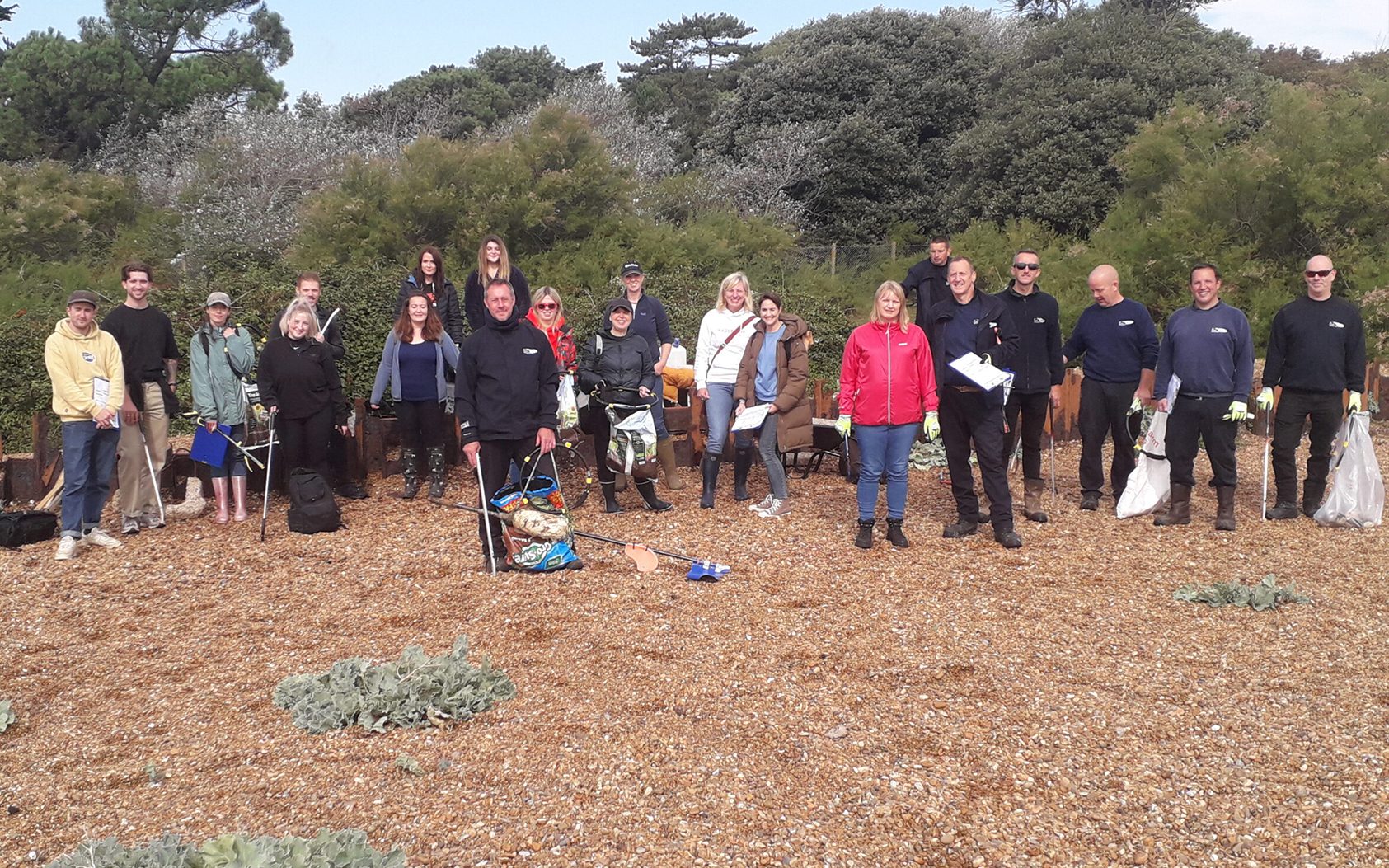
The 2023 Great British Beach Clean 2023 is now complete!
Tom Fairbrother, Coast and Heaths AONB
The Coast & Heaths Area of Outstanding Natural Beauty team organised three surveys/cleans – two for registered volunteers at Kessingland and Havergate Island, and a corporate survey/clean at Bawdsey Point for UK Power Networks and Royal Society of Chemistry members.
Across the three events, 48 people attended. In addition, the Coast & Heaths team supported five other events by loaning out equipment. In total there were 11 events taking place within the Area of Outstanding Natural Beauty involving almost 200 people.
The Great British Beach Clean is an annual event organised by the Marine Conservation Society. Every September thousands of people across the UK head to the coast to take part in the Great British Beach Clean, a week-long citizen science event, where hundreds of beach cleans take place up and down the UK.
For more information or any questions, please contact Countryside Projects Officer, Neil Lister, at [email protected].
You can find out more about our Beachwatch events on our website.
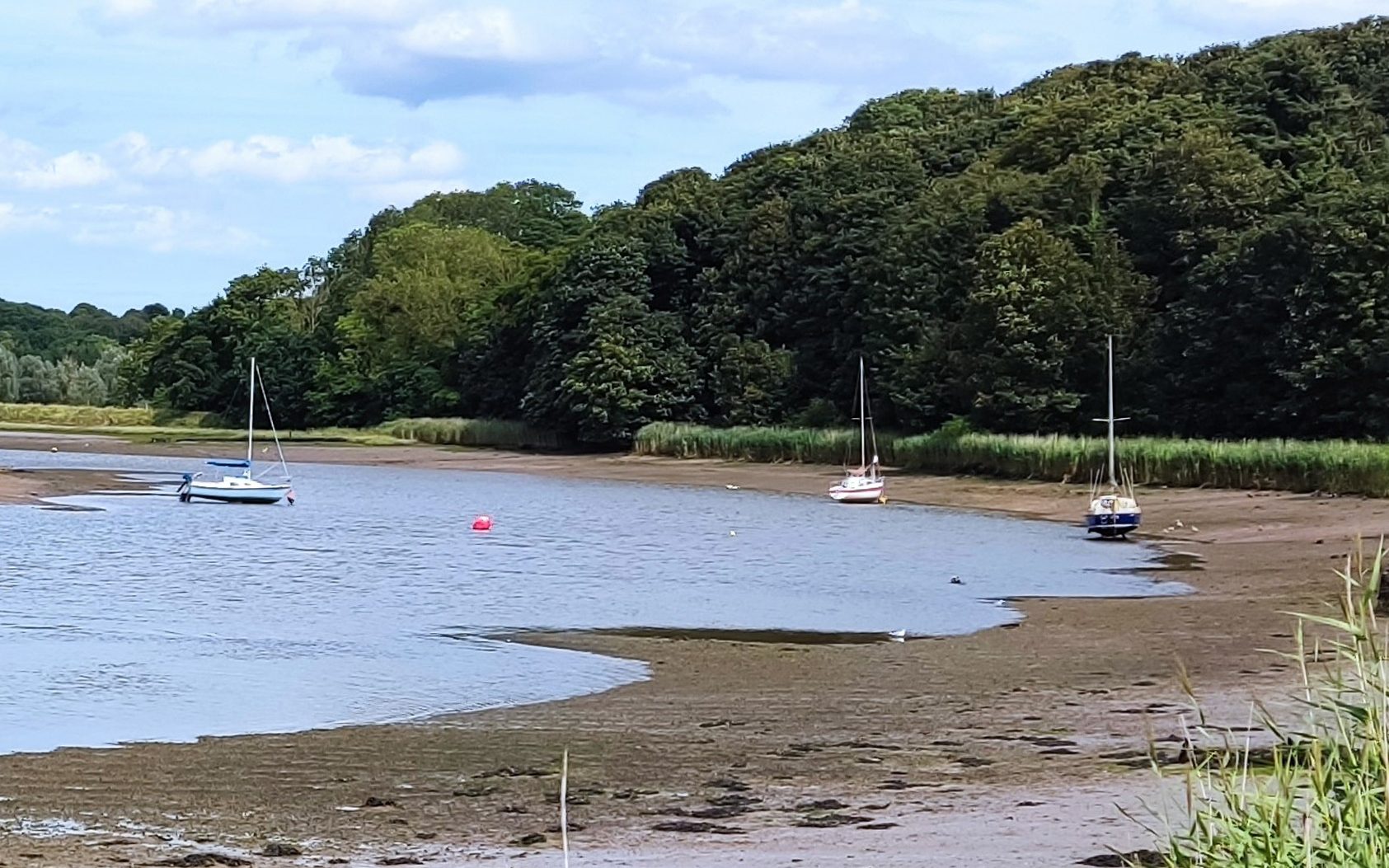
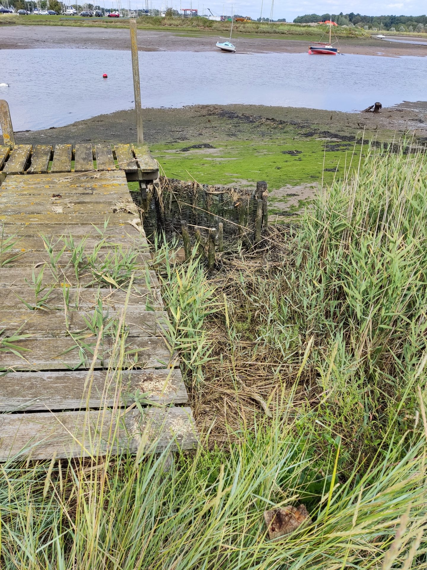
Ferry Cliff SSSI
Caroline Markham, GeoSuffolk
Looking north-east along the Deben with foreshore showing at low tide. The darker brown areas are the Palaeocene beds.
This summer GeoSuffolk was asked to assess the geological SSSI at Ferry Cliff, on the River Deben estuary, for Natural England.
This 400m stretch of cliff and foreshore is of geological interest because deposits of Palaeocene age (58 million years old) here yield an important mammalian fauna. Some are amongst the earliest members of modern orders of mammals, including the oldest British rodents and hoofed mammals. The problem is that the fossiliferous Palaeogene sands are only exposed on the shore, below high water. They sit underneath the London Clay and Red Crag which, as is the case in most of our south Suffolk estuaries, form unstable cliffs bordering the river.
The survey for NE is to check access to the geology in the SSSI – parking, footpaths, and (in this case) access to the shore. NE is also concerned with this SSSI that the cliffs retreat naturally (open to fluvial and mass wasting processes) in order that there is access to the fossiliferous deposit below them. The site is in the ownership of the Natural Trust and is accessed by public footpath from Sutton Hoo. The path along the foot of the cliff is well-maintained by the National Trust, with multiple wooden bridges and boardwalks crossing the springs and seepages issuing from the Red Crag/London Clay junction.
The Red Crag comprising the top part of the 20m high cliff is permeable and water pours out of it at the junction with the London Clay which is impermeable and forms the base of the cliff. This makes it difficult to approach the foot of the cliff. It also renders the whole structure very unstable - we walked across hummocky ground denoting old landslides and came to a very recent cliff fall (almost certainly last winter) with the Red Crag exposed in the back wall.
The foreshore is best seen from the old disused ferry jetty at the end of the footpath. There is a good set of steps up the cliff to the field above and then the jetty is accessed via the field boundary (there is a public footpath here, but it is difficult to discern). The Palaeogene deposits can be viewed from here. (Some years ago, we did, with some difficulty, access the shore here and inspect the Palaeocene bed in situ. It included conglomerate with flint and clay pebbles, fossil shells and shark teeth.)
We found the SSSI to be well-accessed with its geology in good condition and with the cliff receding as per the NE directive. The main problem with this site is that the fossiliferous deposits are only accessible for about an hour either side of low tide – indeed we had to make two visits in order to be able to photograph the shore exposed for the full length of the SSSI.
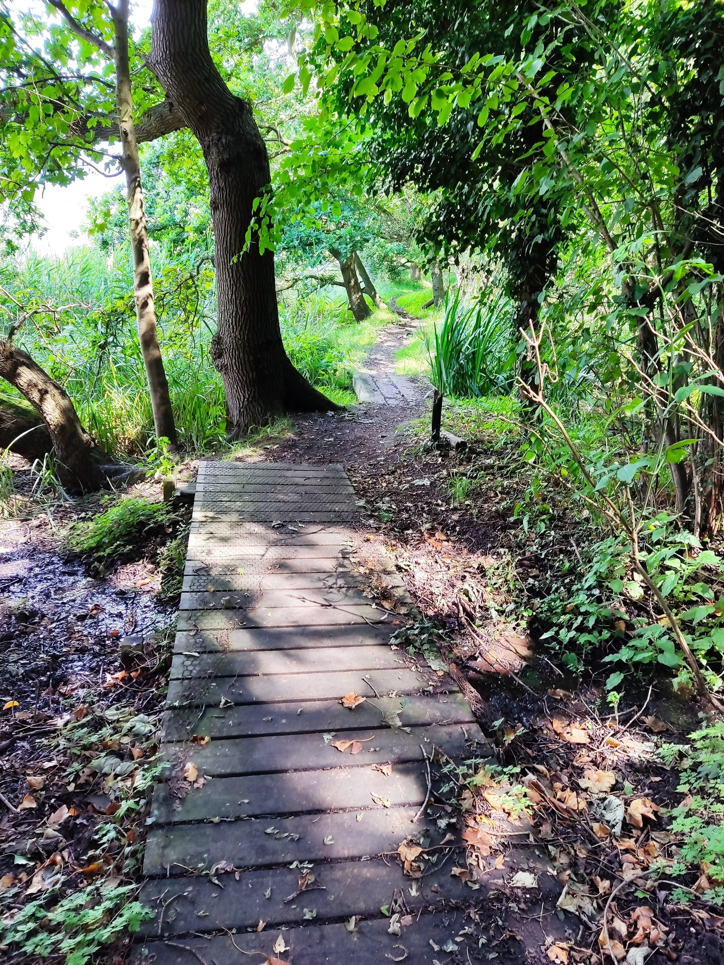
Looking north along the footpath (running close to the River Deben at this point) and showing two of the small bridges over the spring water from the cliff.
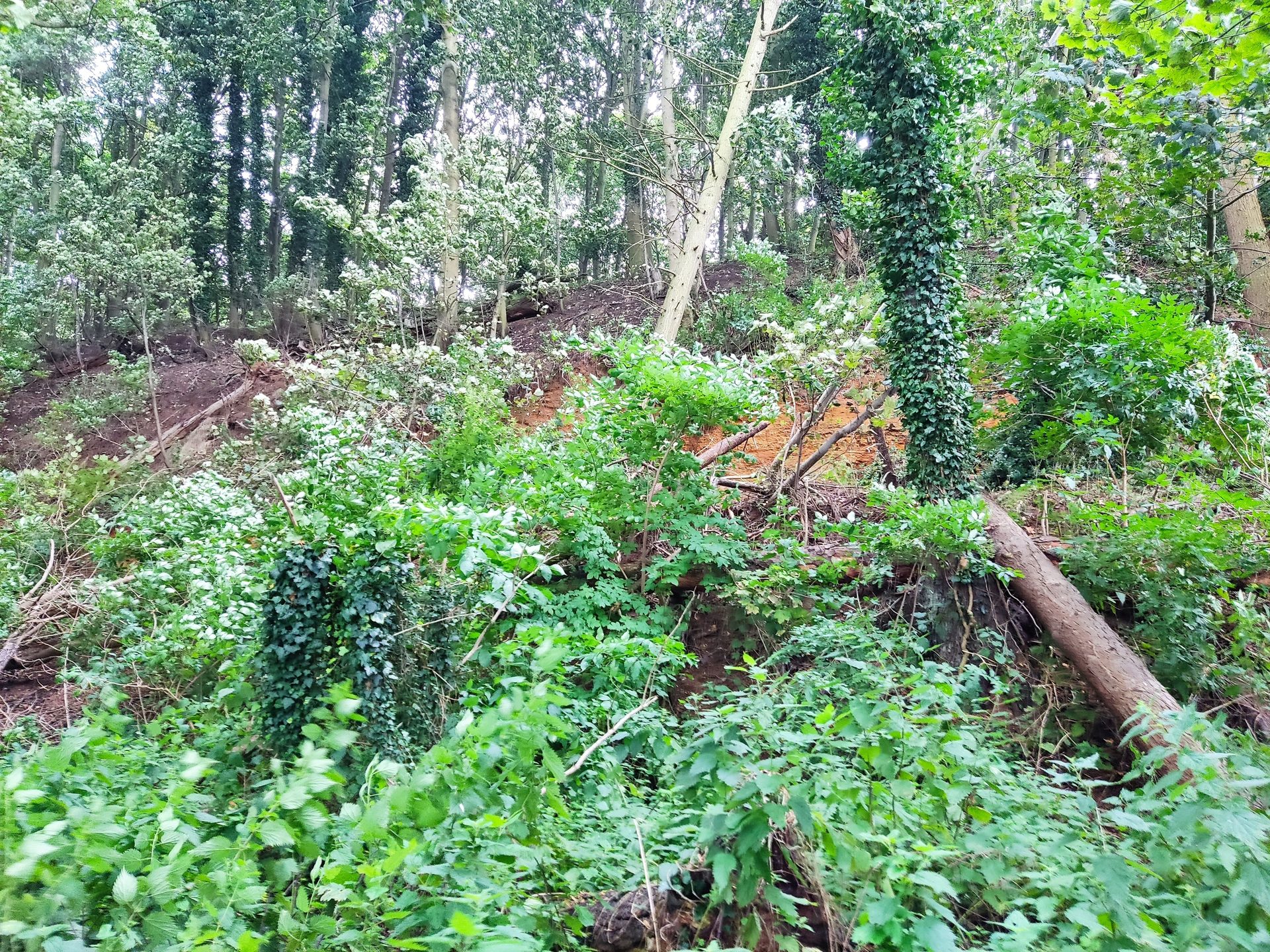
Looking inland at the recent landslide with fallen trees, including some backwards rotated. This form of movement is common on landslides involving the Red Crag/London Clay along Suffolk and Essex estuaries.
Looking north across the shore (Woodbridge Marina is on the opposite shore) beside the old ferry jetty. The foreshore with Palaeocene deposits can be viewed at its closest point to the shore here.
Nature and communities set to benefit from £33,000 funding boost
Tom Fairbrother, Coast and Heaths AONB
Hazel coppice at Captains Wood © T. Pick
A host of exciting projects in Suffolk have received significant funding to engage local communities of all ages with nature to improve health, access, and connection to their surroundings.
The annual Sustainable Development Fund awards grants up to £5,000 for community projects that will help to conserve and enhance the natural beauty of the Coast & Heaths Area of Outstanding Natural Beauty.
For the 2023-24 year, 12 projects were successful with their applications, with a combined total of £33,548 awarded. Several of the projects that received funding will work with different demographics to improve diversity and inclusivity.
The Letters in the Landscape project will see six primary schools within the Coast & Heaths area take part in walking photography projects, whilst the Landscapes for All project will utilise public transport links in the area to engage diverse and underrepresented communities through guided nature/wellbeing walks and educational activities.
The ever-popular Orford Ness National Trust site will deliver ADHD and Autism Awareness training to staff and volunteers and provide content recorded in British Sign Language for visitors, funded by Sustainable Development Fund grants.
Other projects funded include beachcombing activities for all ages and levels of mobility in six Suffolk libraries, an educational volunteering project in Rushmere, the introduction of Nordic Walking sessions and art sessions to communities in Aldeburgh and Thorpeness, and the production of climate change awareness information in Brantham.
Birds and nature will also benefit with three exciting projects to support conservation important species and habitats. Funding was awarded for the construction of the Eastbridge Swift Tower within the grounds of The Eels Foot Inn, Eastbridge, to boost swift populations.
RSPB Havergate Island received awarded funding Spoonbill deep water feeding creation project. A Suffolk Wildlife Trust conservation project will see the protection of hazel trees beneath the high canopy of the ancient oaks at Captain’s Wood.
The Sustainable Development Fund aims to benefit the Coast & Heaths, with funds provided by the Department for Environment, Food and Rural Affairs (Defra).
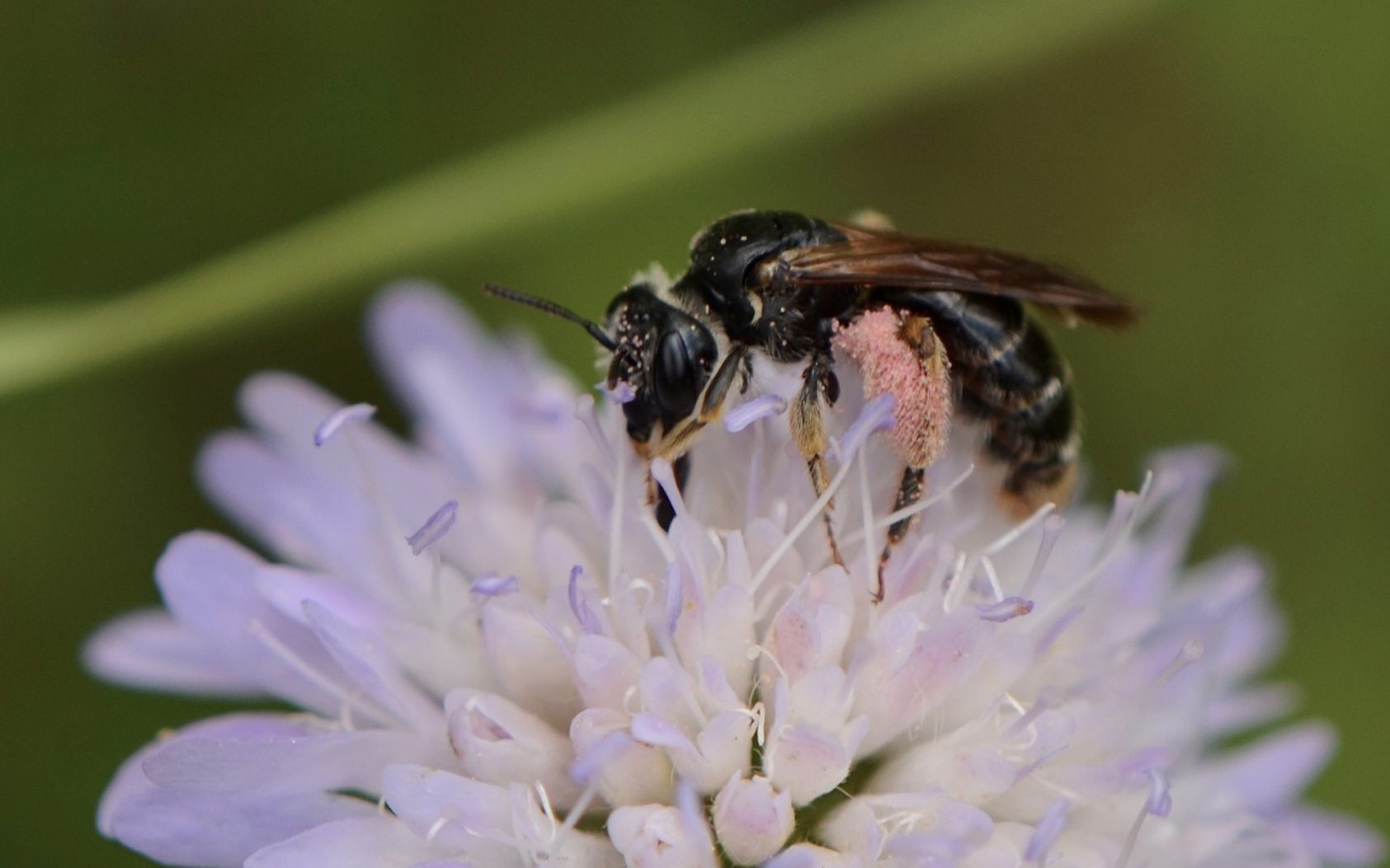
Scabious Specialists
David Dowding, Ipswich Borough Council
Scabious mining bee at Holywells Park (Photo Sam Chamberlin)
Since the early 2000’s large patches of the parks and open spaces around Ipswich have gradually been rewilded, through various projects, and it’s fantastic to see some of the long-term results.
The “Urban Buzz” project which ran for 20 months up until 2019, provided a sizeable resource to create a series of wildflower patches around the town improving upon the long grass areas set aside in 2011. This has not only increased abundance of common/existing invertebrates but also allowed new inhabitants to colonise some of these areas.
Field scabious
One of the best wildflowers for pollinating insects is field scabious, a member of the honeysuckle family, this lilac flowered herbaceous perennial has a long flowering season from June through to September.
Although most prevalent on calcareous based habitats it still grows well on other soils and is always included in our wildflower seed mixes.
Over the last couple of years, we have noticed two nationally scarce species associated solely with scabious, which indicates how well the plant is doing in the town.
Large scabious mining bee
As with many mining bees (andrena sp.) sandy soil is needed for the excavation of burrows, but this specie’s unusually specific pollen choice for feeding its larvae (oligolectic), is the reason for its scarcity.
Field scabious tends to grow on heavier soils – usually chalk or clay- but on these sites there is often limited burrowing opportunities.
The classic habitat in Suffolk would be the Brecks where the geology alternates from chalk to sand naturally due to periglacial striping.
However, in manmade sites such as parks and recreation grounds the soils are often quite varied due to imported topsoil’s, dredging of ponds, urban construction and the capping of Landfill which seems to have allowed the complex needs of this species to be met.
Another scabious specialist is the brassy longhorn moth. There are several types of Nemophora in the Uk , each with a specific foodplant. They are tiny but often very beautifully marked, with the males exhibiting outrageously long antennae, 3 times the length of the body!. This particular species feeds solely on the seedheads of field or small scabious, and once fully grown overwinters as a larva in the leaf litter underneath. A nationally scarce species with very few records in Suffolk, it was great to find at several Ipswich sites, however it would appear it may be somewhat under recorded. Now that a discussion has been opened up on a Facebook page, a few new colonies have been discovered by suffolk naturalists checking their local scabious patches.
The moth tends to do better in scrubbier habitats as the larvae overwinter in the leaf litter and won’t respond well to a high percentage of cutting such traditional Hay meadow management. Soil type doesn’t seem to be an issue but a rotational management or light grazing i.e., rabbits is important.
Management on rotation
The key to success is the continuous but rotational management of the grassland, and the provision of bare ground, which is often achieved when sowing seed into new areas.
For wildflowers mowing is essential as it maintains a low nutrient habitat and reduces grass competition and ultimately scrub succession, but for overwintering invertebrates it’s very important that sections are left for various parts of their lifecycle.
Many of the grassland butterflies need flowers for nectar, but at the same time they lay their eggs on the dead grass stems so cutting these sections even in the autumn will affect these species. By cutting areas on rotation, we can provide the best of both worlds and ensure plenty eggs/larvae are missed without compromising the abundance of wildflowers.
One of the simplest ways to achieve this is to split each area into strips and alternate the mowing, ending up with a patchwork of cut and uncut grass. The following year the opposite sections will be cut meaning no area of flowers gets too overgrown.
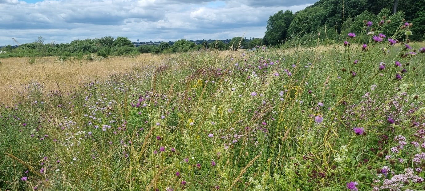
Wildflowers at Landseer Park
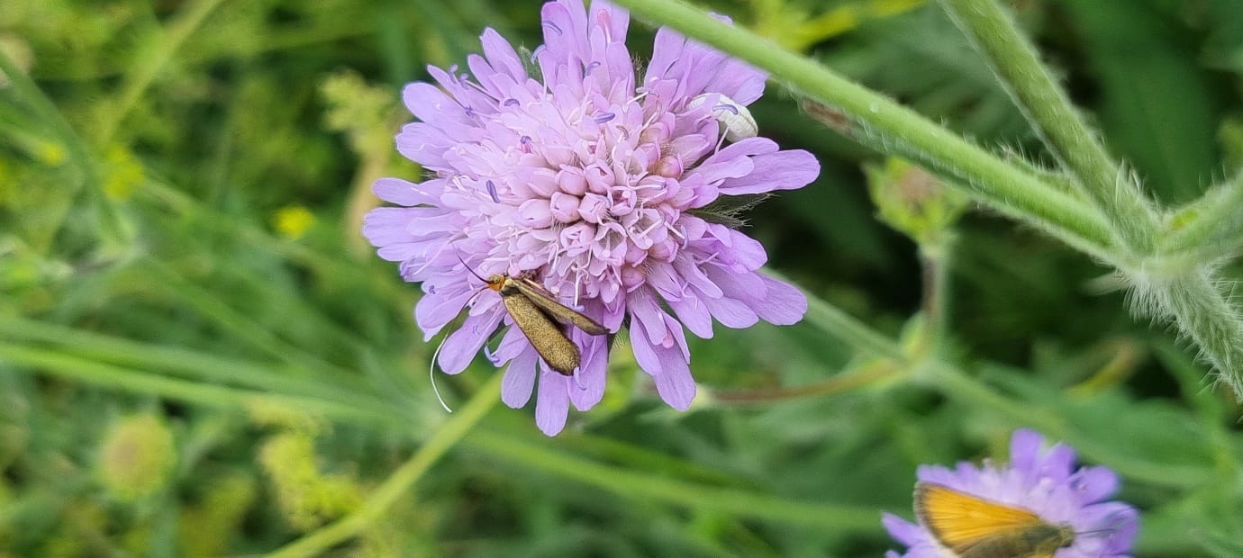
Brassy longhorn (micro moth) ovipositing on a Scabious flower head
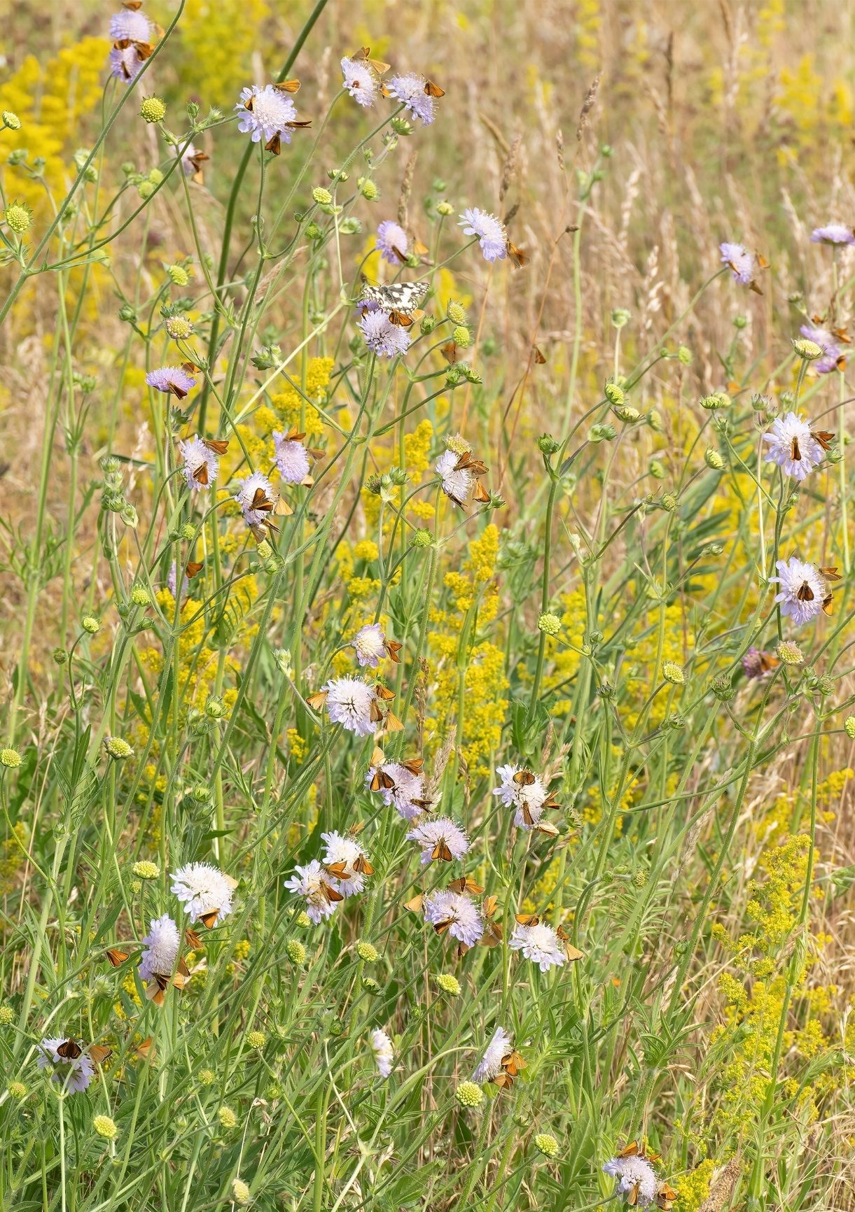
Abundant skippers on scabious growing in a rotational mowed section of grassland (Peter smith)
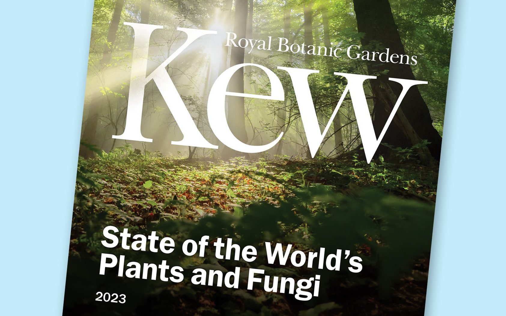
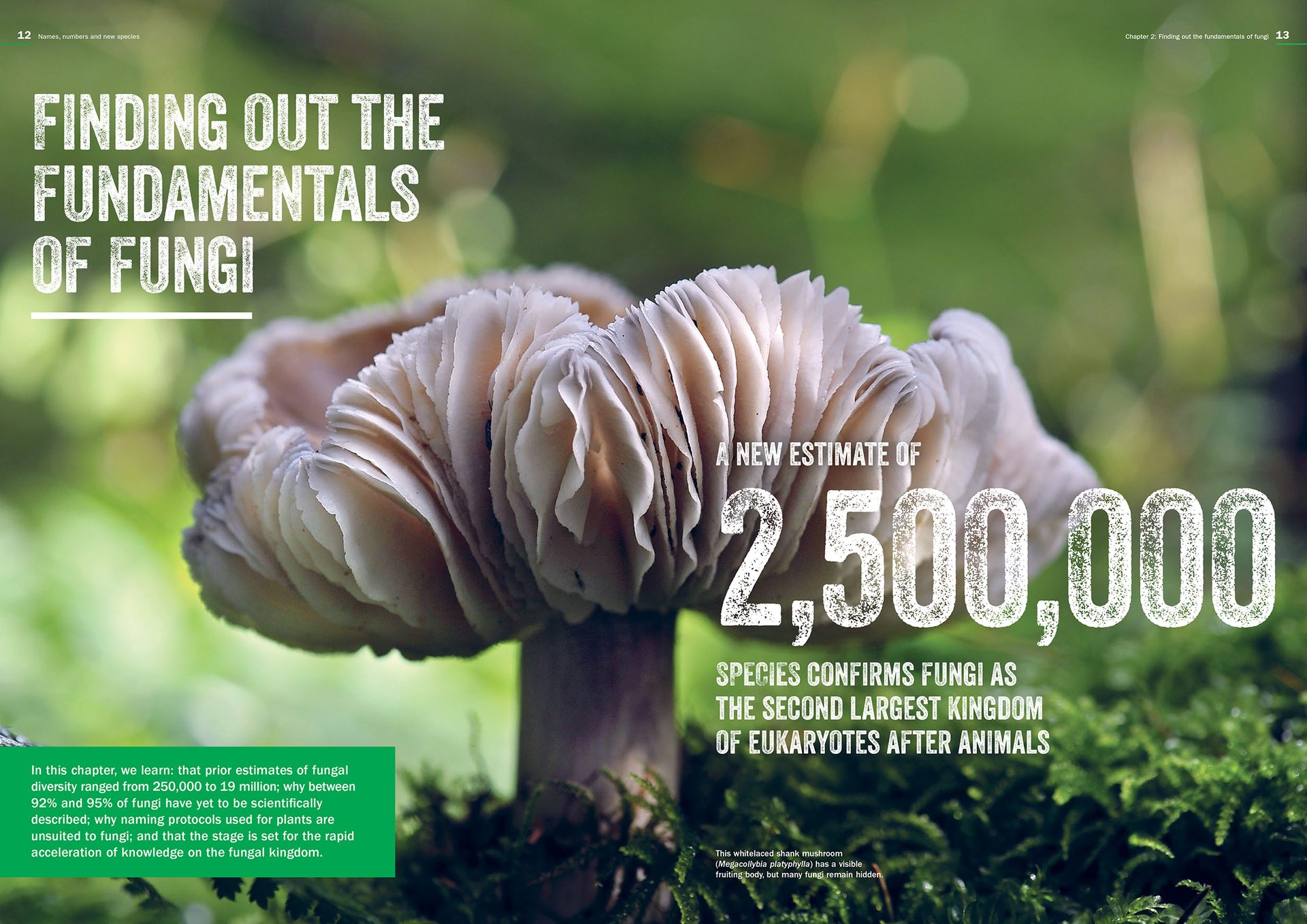
New report on plant and fungi diversity
Kew’s State of the World’s Plants and Fungi project provides assessments of our current knowledge of the diversity of plants and fungi on Earth, the global threats that they face, and the policies to safeguard them.
Produced in conjunction with an international scientific symposium, the report sets an international standard from which trends in the global status of plant and fungal diversity can be tracked.
It is the fifth report in the series and lays out the current condition of the world’s plants and fungi across the globe.
Drawing upon the expertise of 200 contributors from more than 100 institutions across 30 countries, the report is a global collaborative effort which takes an in-depth look at the worldwide drivers and patterns of biodiversity, provides new insights into extinction risk, and identifies critical knowledge gaps and how to address them.
It presents compelling stories of what can be learnt from new sources of data and how that can be used to foster future research and conservation.
Dark skies, improved access, and broadened horizons in the Dedham Vale
Tom Fairbrother, Dedham Vale AONB
Flatford Bridge and River Stour © Environment Agency, James Fletcher
Children, young people, and underrepresented communities in the Dedham Vale Area of Outstanding Natural Beauty are set to reap the benefits from more than £25,000 worth of grant funding for a range of exciting community projects.
The annual Sustainable Development Fund awards individuals, organisations, and community groups grants up to £5,000 for projects that will help to conserve and enhance the natural beauty of the area. For the 2023-24 year, 11 projects were successful with their applications, with a combined total of £25,259.
The Creative Nature Leaders project from Wyrd Flora will inspire and empower women from diverse ethnic backgrounds to connect with the local environment, learning to engage, respond and create with it through guided walking groups and educational activities.
Another project funded will see people from diverse and underrepresented communities in the Ipswich and Colchester areas take part in guided nature/wellbeing walks through the Landscapes for All project and will utilise public transport links in the area to promote sustainable visiting.
Two exciting projects will connect young people from the local area with their surroundings in engaging ways. First, Dedham C of E Primary School will create a forest school for every year group throughout the school year, encouraging families and children to appreciate the beauty of the area.
Additionally, the Letters in the Landscape project will see three schools within the Dedham Vale take part in walking photography projects, exploring their local environment.
Improved access and sustainability are other key features of the fund. Other grants awarded will see the creation of boardwalks at Tiger Hill and solar panels at Abberton Rural Training.
To conserve the natural dark skies within the Dedham Vale Area of Outstanding Natural Beauty, funding was awarded to support attaining Internationally recognised accreditation and providing an outreach programme to educate the public.
Funding has also been provided for projects to increase public engagement on wildlife in Boxted village, extending the boat landing stage on the River Stour by Flatford Bridge, and archive reporting at the Court Knoll archaeological site.
The Sustainable Development Fund aims to benefit the Dedham Vale, with funds provided by the Department for Environment, Food and Rural Affairs (Defra).
Suffolk Naturalists' Society Autumn Members’ Evening
Thursday 16 Nov
Brian Wangenheim, Unsplash
- Chat and Refreshments – complimentary tea/coffee & biscuits
- (Alcoholic beverages – beer/wine/soft drinks are available to purchase).
- followed by speakers – to be arranged with a further break for refreshments.
In addition:
- “Show and Tell” nature table
- Natural history books – bring and buy, lend out or give away.


23rd National Biodiversity Network Conference
“Making data work for nature”
The 2023 NBN Conference will take place on Thursday 23 November at the National Museums Scotland in Edinburgh.
- 13 inspirational speakers
- Panel discussions
- Network with like-minded people
- Displays and exhibitors from across the Network
- Hear from recipients of the NBN Awards for Wildlife Recording
- NBN Trust AGM
NBN Conference theme
This year’s theme is “Making data work for nature” to reflect the NBN Trust’s Strategy. The latest programme is available on the NBN Trust website.
Included in the presentations, is an opening address from Màiri McAllan MSP, Cabinet Secretary for Transport, Net Zero and Just Transition and Natalie Prosser, Chief Executive Officer, The Office for Environmental Protection will give the Sir John Burnett Memorial Lecture.
- Session 1: The NBN Atlas is the ‘go to’ place for sharing, finding and accessing UK biodiversity data
- Session 2: Biodiversity data is providing the evidence needed for nature’s recovery
- Session 3: Citizen science is valued, supported and expanded as a major source of biodiversity data
- Session 4: The National Biodiversity Network is a well-connected and highly collaborative community with a united voice on key issues
© Events Jess Bailey, Unsplash
Events
Conferences, Webinars and Training
Suffolk Wildlife Trust
- Discover Suffolk Wildlife Trust • 4 Nov • Carlton Marshes
- Wild Walks: Bird I.D with Paul Holness • 8, 25 Nov, 13, 30 Dec, 10, 27 Jan, 14, 24 Feb • Lackford Lakes
- Wednesday Morning Bird Watching Walks • 8, 22 Nov, 6, 20 Dec, 10, 24 Jan, 7, 21 Feb • Various locations in East Suffolk
- Monthly Wildlife Walks • 8, 26 Nov, 13 Dec, 10, 28 Jan 14, 25 Feb • Foxburrow
- The Broads and its Wildlife • 9 Nov • Southwold Arts Centre
- Discover Suffolk Wildlife Trust • 11 Nov • Lackford Lakes
- Woodland Management • 11 Nov • Bradfield Woods
- Wildlife Live Webinar - Tree galls • 14 Nov • Online
- Havergate Island with Steve Everett • 21 Nov • Broadway House, Felixstowe
- A Morning on the Marshes-Guided Walk • 25 Nov • Carlton Marshes
- Natures Prism • 28 Nov • Redgrave & Lopham Fen
- Suffolk’s butterflies • 29 Nov • The Village Hall, Stowupland
- Wildlife Live Webinar - Bug Folklore • 30 Nov • Online
- Winter Bird ID • 10 Dec • Lackford Lakes
- Wildlife Live Webinar - Mistletoe • 11 Dec • Online
- Level 3 Botanical Drawing & Painting • 8 Jan on • Carlton Marshes
- Wildlife Live Webinar - Mammal tracks and signs • 11 Jan • online
- Winter Bird photography • 20 Jan • Lackford Lakes
- Winter Tree ID • 20 Jan • Foxburrow and 21 Jan • Bradfield Woods
- Wildlife Live Webinar - Composting • 25 Jan • Online
- The Changing Wildlife of Redgrave & Lopham Fen: an historical perspective • 30 Jan • Redgrave & Lopham Fen
- Winter Bird photography • 3 Feb • Lackford Lakes
- Wildlife Live Webinar - Gardens & Climate Change • 6 Feb • Online
- Wildlife Live Webinar - River habitats • 21 Feb • Online
- Suffolk Shingle. Tales of Treasure and Trash with Kate Osbourne • 28 Feb • Museum Street Methodist Church, Ipswich
- Wildlife Live Webinar - Why bugs matter • 4 Mar • Online
- Wildlife Live Webinar - Martlesham Wilds • 12 Mar • Online
Full details and other SWT events
Field Studies Council
Natural History Courses
Covering all aspects of the natural world for beginners, enthusiasts, volunteer recorders and professionals.
Professional Development for Ecologists and Conservationists
An extensive range of courses that cater to a range of career levels, providing wildlife identification and surveying courses in many subjects.
The Species Recovery Trust
Online courses
- Around Britain in 25 sedges
- UK Wildlife & The Law
- UK Wildlife & The Law
- Great Crested Newts - Ecology, Conservation and Survey
- Invasive Species
- Winter Tree ID
- Around Britain in 25 Grasses
- Around Britain in 30 Bryophytes
- Around Britain in 20 Ferns and Allies
- Around Britain in 20 Rushes
- How to Survey and Assess Hedgerows using the Hedgerow Regulations
- Grasses Part Two
- Great Crested Newts - Ecology, Conservation and Survey
- Heathlands and Acid Grassland - Species and Habitat Survey
- Aquatic Plant ID
- Woodlands - Botanical Survey
- Habitat Indicator Species
- Invasive Species
- Around Britain in 25 Sedges
- UK Wildlife and The Law
London Natural History Society
Royal Entomological Society
- Orthoptera Special Interest Group (SIG) 2023 • 8 Nov
National Biodiversity Network
RSK Webinars
The First Thursday Club is a monthly scientific, specialist-led webinar, on best practices relating to the natural environment.